How to price drone and photogrammetric services (including road/infrastructure).
When?
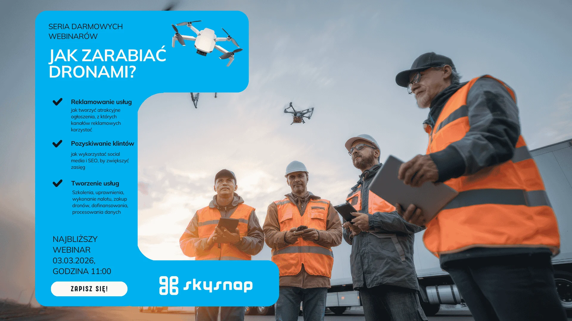
- Date: 03.03.2026 (Tuesday)
- Time: 11:00-12:00 (CET)
- Format: online (Google Meet)
For whom?
For individuals and companies that sell or want to sell UAV/photogrammetry services – especially in the areas:
- Infrastructure / linear (road) investments,
- geodesy and photogrammetry,
- construction and investment supervision,
- drone operators to raise rates and stop “adding to projects.”
What will you learn ?
- How to count the cost of performing the service (equipment, labor, travel, processing, corrections),
- How to take into account risks and variability in scope (terrain, weather, paperwork, accessibility, security),
- How to build packages and price list (variants: minimum / standard / premium),
- How to talk to customers about price: selling value, not “price per flight.”
- Where the margin most often escapes and how to prevent it (scope creep, “extras”, patches).
Agenda
- How customers compare offers and what they realistically pay for in drone services
- Pricing model: fixed vs variable costs + “risk buffer”
- Pricing of photogrammetric and infrastructure services: scope, end products, liability
- Packages / price list / terms and conditions (what needs to be in the offer so that it does not “roll out”)
- Q&A – your cases, questions, examples
Leading
- Pawel Wojcik (guest)- Director of Business Development at SkySnap. A pioneer and evangelist of digital transformation and digitalization in the construction industry.
- Agnieszka Kordus (SkySnap) – presenter
Why is it worth it?
Because it’s a “down to earth” webinar – about the realities of the market and how to price so that the project has a challenging but realistic margin, and so that your bid is clear and comparable (without underselling).
dron
fotogrametria
fotogrametria dronem
Datorobcy
Datobiorcy
regularne przychody dronem
zarabianie dronem
Pomiary i raporty 2D vs modele 3D
seria – zarabianie dronem
drony na budowie
seria – efekt drona na budowie
obliczanie objętości dronem
usługi obliczeniowe
liczenie objętości dronem
drony w budownictwie
drony w budownictwie liniowym
wyróżnione
Portal SkySnap 2.0
powiązane z aktualizacjami produktowymi
polecane drony
seria – aktualizacje produktowe
LiDAR
BIM AGA
pomiary dronem
seria – drony w nieruchomościach
płatności za usługi dronowe
GIS
BIM
mapa lotów dronem
Raporty automatyczne i analiza objętości hałd
dane przestrzenne
pomiary hałd
drony w monitorowaniu przestrzeni magazynowych
Moduł pomiaru hałd z drona
Pomiary liniowe infrastruktury energetycznej
Analiza 3D inwestycji
Inspekcja dachów i elewacji dronem
Drony w branży telekomunikacyjnej
Analiza objętości materiałów ziemnych z drona
dokładność pomiaru z drona
Pomiary terenu dronem
Model 3D budynku z drona
Monitoring postępu prac z drona
Ortofotomapa z drona
dane geoprzestrzenne
Tips, news, insights
Related articles
Check out our articles and get the latest industry news.


")
")

")
")