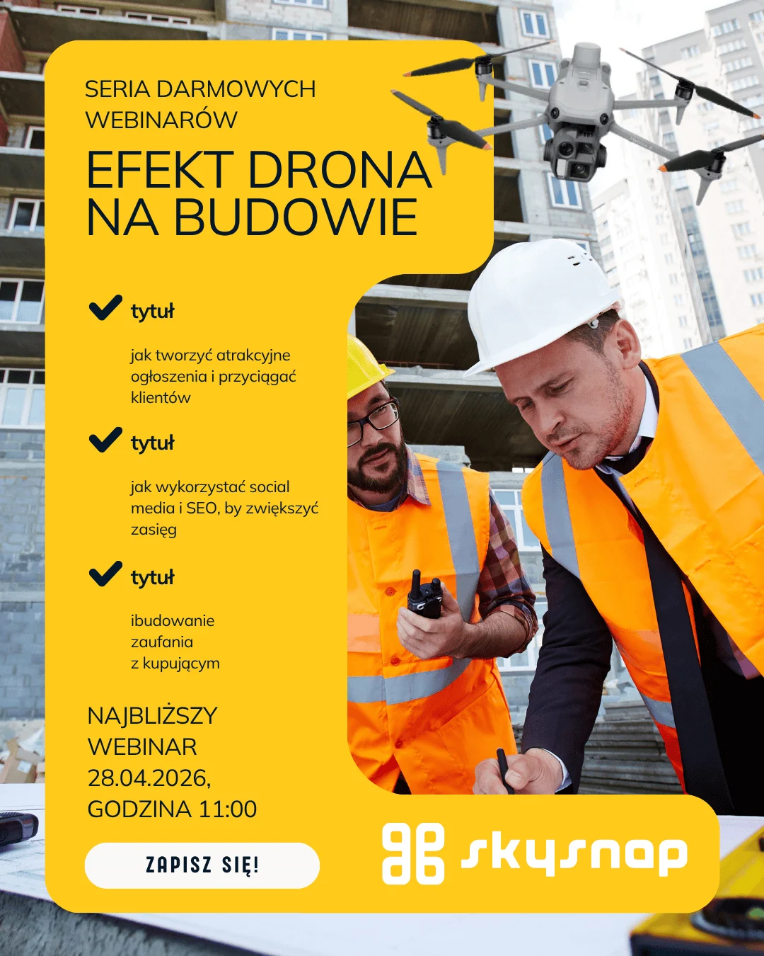
Drones in real estate: Roof inspection by drone for property managers
Join us for a webinar to show how SkySnap technology supports Property Managers, Communities and Cooperatives in reliably assessing the condition of a roof.
We will focus on how to turn hundreds of drone images into a concrete technical report, which is the basis for planning renovations and discussions with contractors.
This meeting is for you if:
- You manage a portfolio of properties and are looking for a way to quickly verify the condition of roofs in multiple locations.
- You are preparing a renovation plan and need hard data to justify the expenses to the board or residents.
- You’re liquidating damage after windstorms or rainstorms and require irrefutable documentation for the insurer.
- You want to avoid the risks associated with sending people to the roof just to “check what’s going on.”
What will you learn during the meeting?
Instead of theories about flying, we will focus on the usefulness of data for your work:
- Roof audit 2.0: What does the drone see that the eye of a worker on the roof won’t see? (gutters, attics, roofing, chimneys).
- Photos aren’t everything: How to tell the difference between an amateur service and a professional SkySnap technical report.
- Cost optimization: How to use drone documentation to negotiate with contractors and accurately determine work estimates.
- Thermal imaging and measurement: when it’s worth investing in extended roof leakage diagnostics.
- Case Study: Examples of savings generated by early detection of plating defects.
A tangible benefit: Your Contracting Officer’s Package
Webinar participants will receive the author’s Professional Inspection Checklist.
It’s a ready-made tool that prompts you:
- How to formulate an inquiry to get valuable data, not just “pretty pictures.”
- What elements of the report to emphasize when receiving the service.
- How to implement inspection results into your property management system.
The presenter:

Agnieszka Kordus, SkySnap. Na co dzień doradza zarządcom nieruchomości, jak wdrażać nowoczesne technologie, które realnie odciążają zespół administracyjny i obniżają koszty operacyjne.
Paweł Wójcik, SkySnap Ekspert techniczny, który “zjadł zęby” na analizie danych z drona. Pokaże, jak w praktyce wygląda platforma SkySnap i udowodni, że cyfrowa dokumentacja dachu to najsilniejszy argument w rozmowach z wykonawcami remontów.
Why spend 45 minutes with us?
Because instead of a presentation about drones, you’ll get a ready-made model for managing roof infrastructure. You’ll learn how to order inspections that save you time, your repair budget, and provide peace of mind during fall maintenance.
Practical information
Czas: 23.04.2026 (czwartek), godzina 11:00
Forma: Webinarium online (nagranie dostępne później na kanale SkySnap na YouTube).
Koszt: Bezpłatny.
Rejestracja i szczegóły: https://skysnap.com/webinary.

Tips, news, insights
Related articles
Check out our articles and get the latest industry news.


")
")

")
")