How accurate is drone mapping? A practical guide for everyone
Drone mapping is becoming increasingly popular, and its accuracy is surprising many users. Thanks to modern technology, drones are able to capture data with incredible precision, making them an invaluable tool in many fields such as agriculture, construction and surveying. In this guide, we’ll take a look at how drone mapping works and what factors affect its accuracy. You’ll also learn how to use these devices in practice to get the best possible results. If you’re wondering if a drone might be the right tool for you, keep reading to learn all about its capabilities.
Introduction to drone mapping
An introduction to drone mapping gives us the opportunity to understand how this tool works and the benefits it brings. Drones have become an invaluable support in many industries, changing the way we look at spatial data collection and analysis.
What is drone mapping?
Drone mapping is the process of creating detailed maps or terrain models using drones equipped with cameras and other sensors. The technology allows for the precise collection of data, which is then processed to create accurate visualizations.
For example, drones can take aerial photos that, when combined, form a mosaic of images. This makes it possible to create three-dimensional terrain models, which is particularly useful for urban planning and landscape analysis.
Drones have become a tool not only for professionals, but also for amateurs who want to understand and document the world around them in a new way.
Why use drones?
Drones offer unique advantages that make them attractive for a variety of applications. First, drones are more flexible and versatile than traditional mapping methods, allowing for faster and more accurate data collection.
Drones can reach hard-to-reach places that would be inaccessible or dangerous to humans. Their ability to operate at different heights allows them to obtain data from different perspectives, which is crucial in many industries.
The cost of drone operations is often lower compared to traditional methods, making the technology more accessible to smaller businesses and individual users.
Basic applications of mapping
Drone mapping is used in many fields.
In agriculture, drones are used to monitor crops, enabling farmers to optimize yields and manage resources.
In the construction industry, drone mapping allows for accurate planning and monitoring of work progress. Drones can quickly provide the data needed to assess the condition of structures, which is key to preventing potential problems.
In surveying, drones make it possible to measure land quickly and accurately. They are an invaluable tool in creating topographic maps and other projects that require precise data.
Accuracy of drone mapping
The accuracy of drone mapping depends on a number of factors that can affect the quality and precision of the data obtained. In this section, we take a look at what determines this accuracy and what advantages it offers over traditional methods.
Factors affecting accuracy
The accuracy of drone mapping depends on several key factors.
The first is the quality of the equipment, especially the camera and sensors used to collect data. Better equipment usually produces more accurate results.
Another factor is weather conditions. Conditions such as wind, rain or fog can affect the quality of the data collected, so it is important to plan flights in suitable conditions.
The skill of the drone operator also matters. Operators with more experience can get better results through optimal mission planning and precise drone control.
Comparison with traditional methods
Drone mapping offers several advantages over traditional methods. The key differences are listed below:
| Factor | Drone mapping | Traditional methods |
|---|---|---|
| Relization time | Short | Long |
| Cost | Lower | Higher |
| Site accessibility | High | Limited |
| Accuracy | High | Variable |
Drones can collect data faster and more accurately, making them an attractive choice compared to traditional methods.
Examples of practical applications
Drone mapping has found application in many practical scenarios. In agriculture, drones are used to monitor plant health and manage water resources, leading to increased production efficiency.
In the construction industry, drones help monitor the progress of projects and identify potential structural problems, which minimizes risks and reduces costs.
Drones are also used in disaster management, where they can quickly provide data on affected areas, enabling rapid response and planning of rescue operations.
Technologies and tools
The technologies and tools used in drone mapping are key to achieving high accuracy and efficiency. Let’s learn about the different types of drones, software and modern techniques that support the process.
Types of drones for mapping
Drones used in mapping vary depending on their purpose and specifications. The most commonly used are drones with high-resolution cameras that provide detailed images of the terrain.
Rotary drones are popular for their maneuverability and ability to hover in place. They are ideal for collecting data in confined areas.
Winged drones, on the other hand, are used where mapping of large areas is needed, as they can cover greater distances in less time.
Data analysis software
Once the data has been collected, the key is to process it properly. Data analysis software plays a central role here, enabling the creation of accurate maps and 3D models.
Popular data analysis tools include Pix4D and DroneDeploy, which offer advanced processing and analysis functions. They can provide accurate visualizations and perform detailed analysis.
The software can automatically combine images and generate visualizations, which speeds up the entire mapping process and makes it more efficient.
Modern techniques and innovations
Modern techniques and innovations in drone mapping are constantly evolving. One of the latest trends is the use of artificial intelligence to help analyze and process drone data.
AI allows automatic recognition of patterns and objects in images, making data analysis faster and more efficient. This makes mapping even more precise and efficient.
In addition, drones equipped with multispectral sensors make it possible to collect data in different wavelengths, which is invaluable for analyzing plant health or soil quality.
Challenges and limitations
Drone mapping, while very advanced, also brings with it certain challenges and limitations. Understanding these aspects is key to realizing the full potential of this technology.
Technical problems and their solutions
One of the challenges in drone mapping is the technical problems associated with operating the equipment. Common problems include engine failures, GPS signal interference or connectivity issues.
Solutions to these problems include regular maintenance and servicing of equipment, as well as the use of trusted and proven navigation systems.
It is also important for drone operators to be properly trained and familiar with emergency procedures to minimize the risk of problems.
Challenged legal and ethical aspects
Legal and ethical aspects are an important part of the discussion of drone use. These issues include privacy laws, safety regulations and flight zone regulations.
Many countries have strict regulations on drone use to protect citizens’ privacy and ensure safety in the airspace.
Drone operators must comply with these regulations to avoid legal sanctions and ensure compliance with applicable ethical standards.
The future of drone mapping
The future of drone mapping seems promising, with many new possibilities on the horizon. Developments in technology, such as AI and machine learning, will improve the precision and efficiency of mapping.
Drones are expected to be increasingly used in new industries, such as logistics and natural resource management. This will create new opportunities for companies and individual users.
Work on new technologies that can reduce the cost and increase the availability of drones will also influence the development of this sector.
Tips and best practices
Understanding how to effectively use drones for mapping is key to achieving the best results. Here are some tips and best practices that can help you optimize your mapping processes.
How to get started with drone mapping?
Getting started with drone mapping requires a few steps. Here’s how you can get started:
- Choose the right drone according to your needs and budget.
- Obtain the necessary permits and familiarize yourself with local regulations on drone use.
- Train yourself or your team in drone operation and data analysis software.
- Mission planning – choose the right time and weather conditions.
Each of these steps is important to ensure the safety and effectiveness of the mapping operation.
The most common mistakes to avoid
When mapping with a drone, there are some pitfalls that can affect data quality. Here are some of the most common mistakes to avoid:
- Inadequate flight planning, leading to inaccurate data.
- Neglecting to maintain equipment, which can lead to failure during missions.
- Ignoring weather conditions that can negatively affect the quality of photos.
Avoiding these mistakes will help produce more accurate and reliable results.
How to improve accuracy and efficiency
To improve the accuracy and efficiency of drone mapping, it’s worth following a few tips:
- Regular updates to drone software and analytical tools.
- Using drones with the highest camera resolution available.
- Optimize mission planning with flight simulation tools.
These measures will help to achieve better results and increase the efficiency of the entire mapping process.
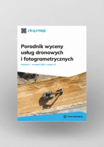
Free E-book
Learn proven methods for pricing jobs: From building structures to large linear and space raids. This guide will help you earn effectively and confidently.
Table of Contents:
Podoba Ci się artykuł? Podziel się nim z innymi!
Podoba Ci się artykuł? Podziel się nim z innymi!
Tips, news, insights
Related articles
Check out our articles and get the latest industry news.


")
")

")
")