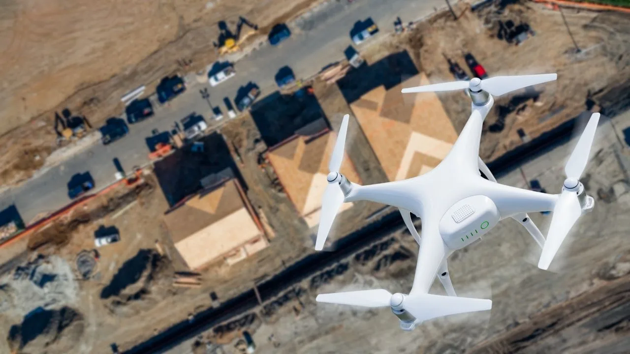
Managing a modern building is a constant battle against the passage of time and the destructive influence of nature. Whether you're looking after an office building, an industrial hall or a housing development, the greatest dangers lurk where the eye can't see - in the highest parts of the structure and in hard-to-reach places. The roof, gutters, flashings and facade details are the front line in the clash with rain, frost and UV radiation.

On the occasion of Surveyor's Day, Megadron and SkySnap have prepared a special promotional campaign for those who want to work faster, more convenient and more professionally. It's an offer aimed at surveyors, drone operators and companies carrying out measurements, documentation and field analysis using BSP technology.

In modern construction and surveying, data has become the new currency, whose real value depends on one uncompromising factor - accuracy. While traditional field surveying has for years been regarded as synonymous with reliability, drone photogrammetry is still sometimes seen by some as a glamorous but risky gadget. This is misguided thinking, as a properly designed raid process and professional processing can achieve geodetic precision of 1-5 cm, saving hundreds of hours of work. Therefore, it is worth considering how to move from the stage of taking aesthetically pleasing photos to creating full-fledged engineering documentation that will pass any inspection.
SKYSNAP Files
News, Novelties, Projects…
See how we develop our solutions and what projects we are involved in
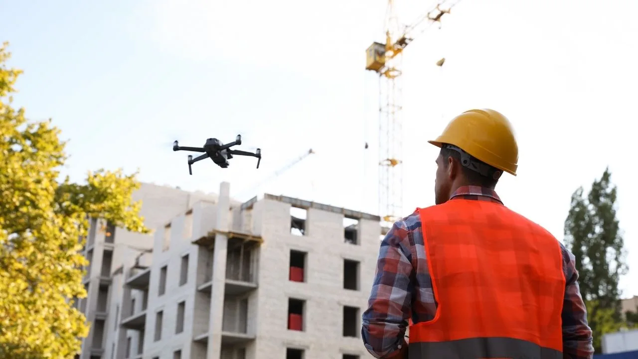
Property managers, communities and insurers are looking for operators who provide a complete report - not just flight footage. Most operators don't know how to structure and price it. In this webinar, we will walk you through the entire process from A to Z.

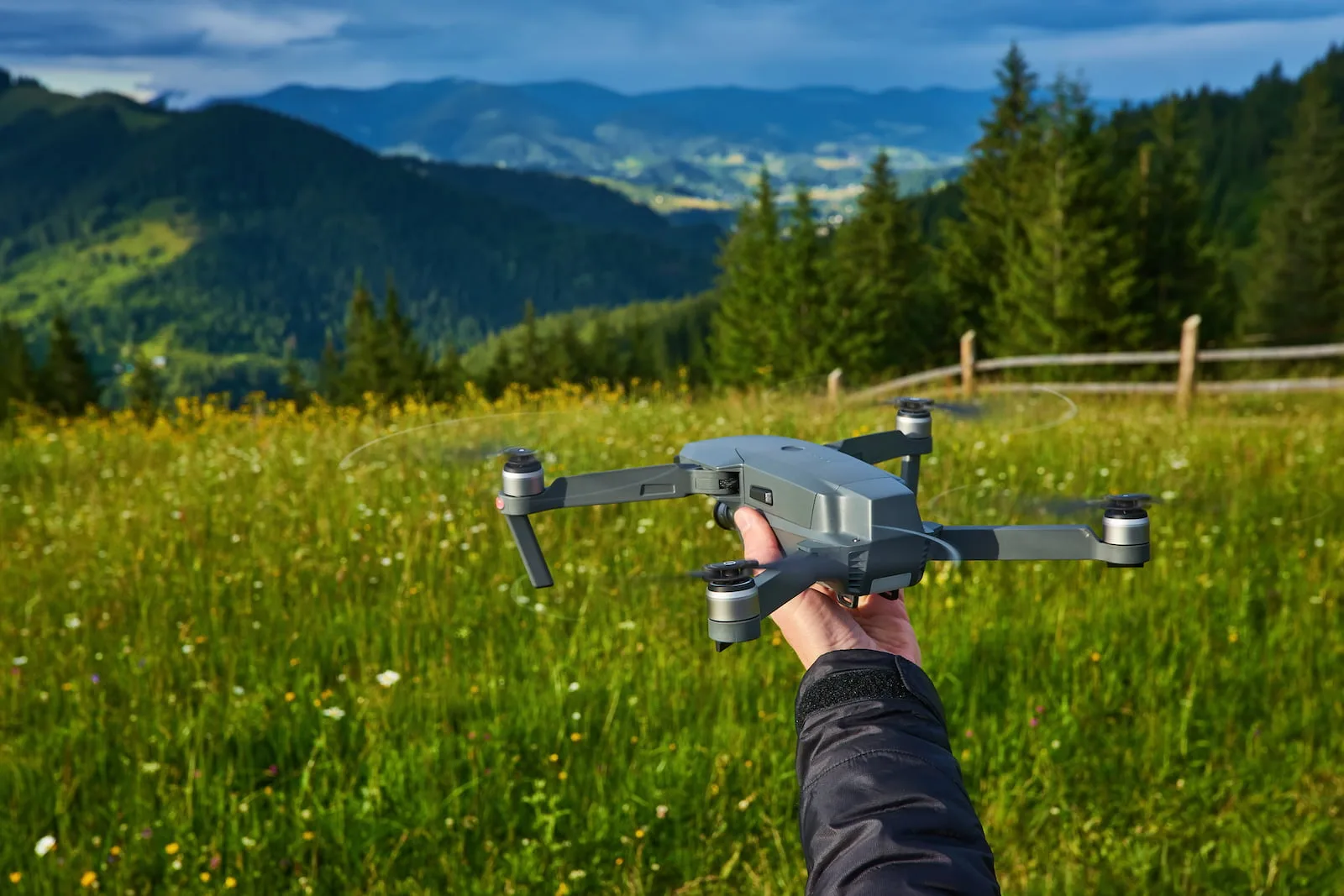
Free SkySnap webinar - 21.04.2026, at. 11:00. We will show a new inspection module for buildings and automatic data processing functions (3D models, orthophotos). Practical demo and implementation ideas for drone companies, surveyors and photogrammetrists.

The roof is one of the most expensive parts of a building... especially when problems are noticed too late. Leaks, damage or lingering water often remain invisible without an expensive and risky visual inspection.
What if you could check the condition of the roof quickly, accurately, and without climbing high?
During the webinar, we will show how to use roof inspection drones in practice - not just to take pictures, but to create real-world useful documentation that supports renovation decisions and conversations with contractors.

It used to be that inventories of waterfronts and reservoirs required difficult point measurements. Today, unmanned technology and the use of bathymetry make it possible to create a complete set of depth data. Having data from above and below the water yields a continuous terrain model which allows for earthwork measurements and spatial analysis.
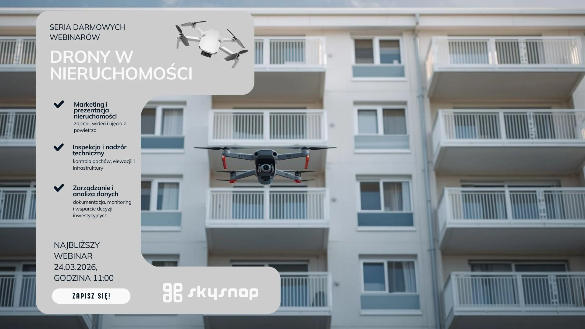
Learn how drones support property managers and housing communities in inspections and documentation. Webinar 24.03 at 11:00 a.m. Check out practical implementations.

In an era of technological innovation, drones vs. traditional construction [...]
Drone technology is gaining popularity and contributing to many advances [...]
Today, technology is constantly evolving, providing us with innovative solutions [...]

Science and technology are improving the quality of life and [...]

An expert panel on what's really working on construction sites today: from AI trends, SkySnap and R&D approaches, to practical Q&A in three areas: automation and reporting, detection/classification, and as-built vs. as-designed (BIM/IFC) comparison.

Free SkySnap webinar: learn how to get funding and grow your drone business - April 14, 2026

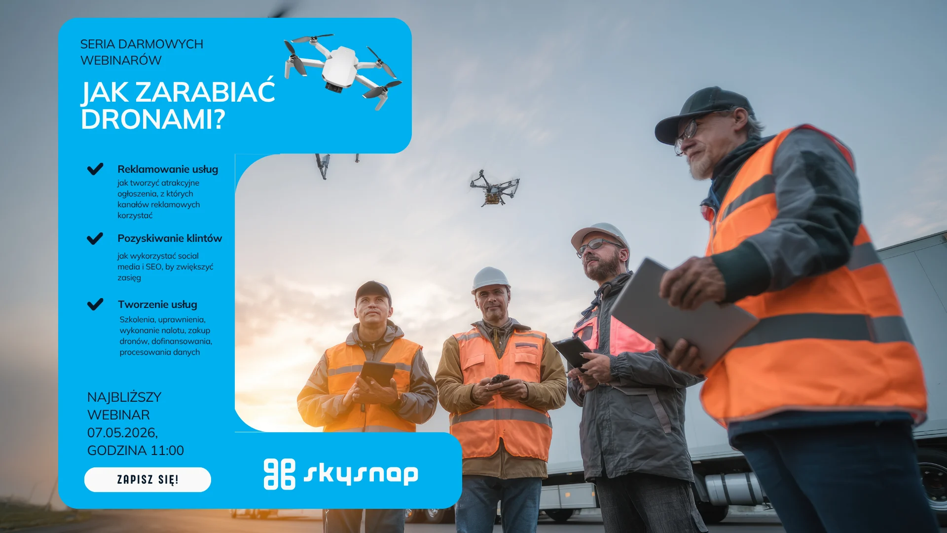
Do you feel that pricing drone services is a "shot in the dark"? In an episode of the series "Earning with a Drone: Photogrammetry" we'll show how to approach pricing realistically and marginally: from costs, to risks and scope, to a bid that defends itself against clients and competitors. Together we'll walk through the key factors of valuation and the typical pitfalls (underestimation, gratuitous "giveaways," overly broad scope).

In the age of new technologies, we are able to [...]
Free SkySnap webinar: find out what drone to buy for professional tasks in 2026! - February 3, 2026
Modern construction is transforming in many ways, but one of [...]
An orthophoto map is a type of map that is [...]

We are proud to announce that SkySnap will be present as an exhibitor at the inaugural edition of Drone World Expo, a new event dedicated to drone technologies and unmanned systems. We invite you to visit the SkySnap booth and discuss the practical use of drone data. See you in Warsaw, March 3–5, 2026.

We are proud to announce that SkySnap will be present as an exhibitor at the 11th edition of DroneTech World Meeting - one of the key events dedicated to unmanned and autonomous technologies. DroneTech has been bringing together industry leaders, innovators and practitioners for years, creating a space for knowledge sharing, technology presentations and networking. The 11th edition of the event is another installment of meetings that are really shaping the future of drones. We invite you to visit the SkySnap booth and talk about practical applications of drone data. See you at DroneTech World Meeting - 11th edition.
The development of drone technology has opened up a whole [...]

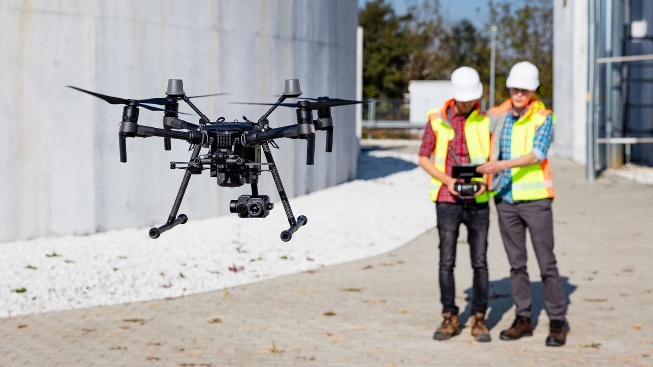
Drones today provide a huge amount of data useful for construction supervision, inventories and monitoring. However, the usefulness of this data depends directly on its quality and on understanding the limitations of measurement methods. During the webinar, we explain the difference between precision and accuracy, what elements affect the results of photogrammetric measurements, and how to interpret and validate portal and report data. We will show practical examples comparing surveyor's measurements with results from drone studies, and present best practices and procedures to guarantee acceptable results in engineering work.
Introduction to 3D modeling of buildings from drones Recent years [...]
Surveying plays a key role in the modern world. Thanks [...]
Nowadays, drone technology is being used in more and more [...]

When we think of drones, we usually imagine a toy [...]
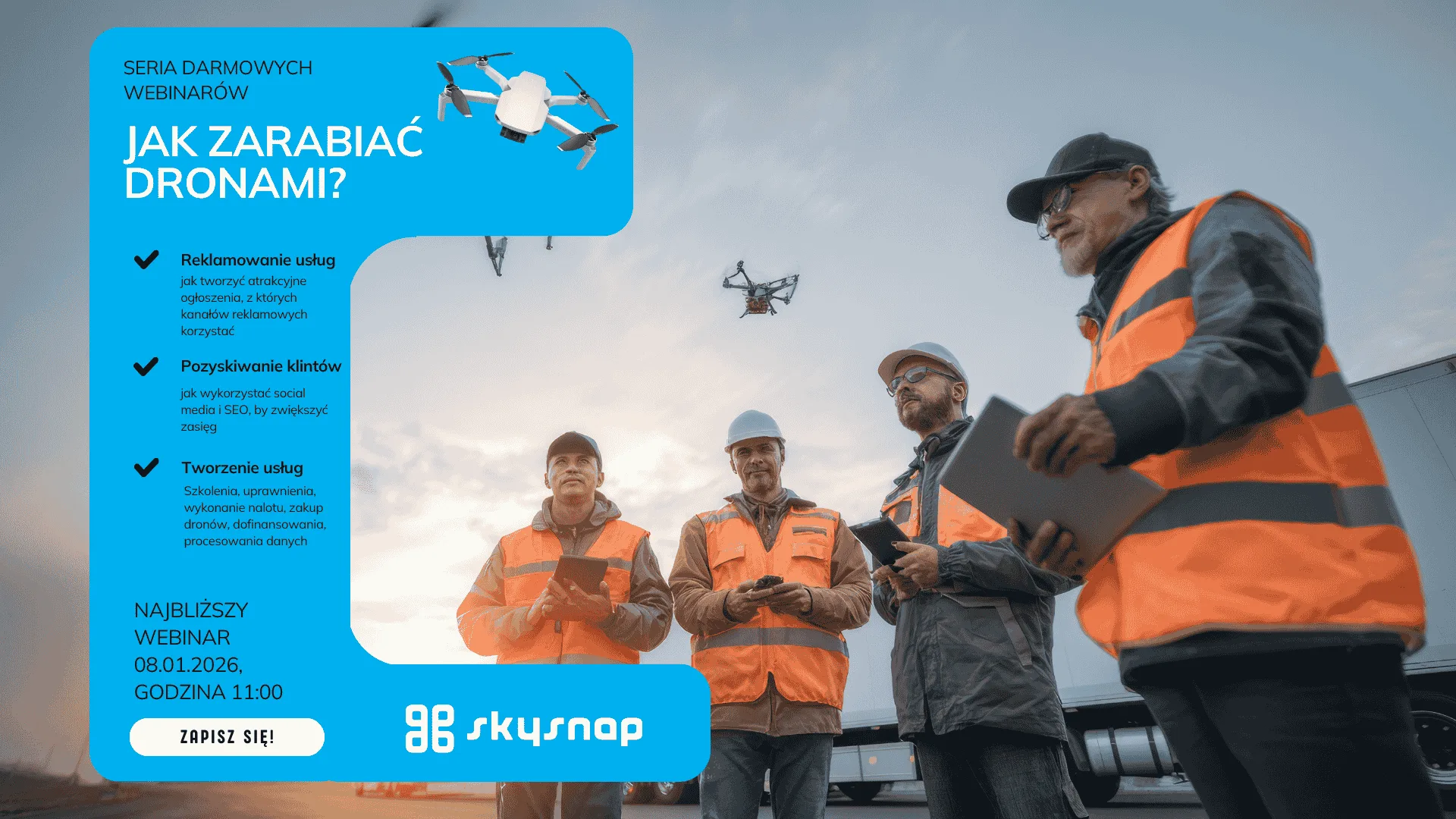
Free SkySnap webinar: learn how to perform a photogrammetric raid with a small drone - January 8, 2026

Digital twin at every stage of the investment process - for existing and planned infrastructure. During the webinar, we will show how SCAN-to-BIM technology together with AI solutions integrate the investment process: from precise bidding, to automatic generation of BIM models, to image analysis used for monitoring the progress of work and infrastructure maintenance. We will present practical implementations and an end-to-end demonstration using SkySnap tools.

Free SkySnap webinar: learn how to plan and execute photogrammetric raids, create orthophotos, 3D models and reports. December 2, 2025 - sign up today.
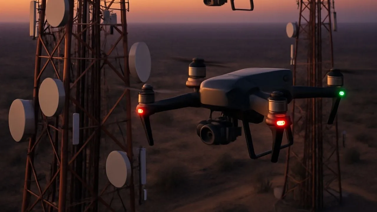
See how drones are improving the inspection of telecommunications infrastructure - faster, safer and cheaper.

Free webinar: integration of SGPR GPR data with orthophotos and 3D models from a drone. Practical applications in construction and geotechnics.
Find out how drone inspection allows you to assess the condition of roofs and facades quickly, safely and at low cost.

SkySnap webinar 6.11 (11:00-12:00, online): 2D/3D measurements, 360° panoramas, IFC/BIM, project management. Practice + Q&A. Join!
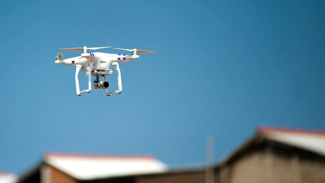
EARNING DRONES: Photogrammetry Episode 2 📸 How to effectively advertise drone services and gain customers 📅 Thursday, November 13 | 🕚 Time: 11:00 | 💻 Format: online
New Series: Drone EFFECT ON CONSTRUCTION 📸 Construction Planning and Monitoring - Drones Not Only on Large Projects 📅 Tuesday, October 28 | 🕚 Time: 11:00 | 💻 Format: online
Drones have permanently entered the business world - supporting construction, agriculture, energy or property management. But one thing is certain: without proper mission planning, even the best drone will not provide useful data. Inappropriate flight altitude, too little coverage of images or failure to take into account weather conditions can render the material useless. That's why we have prepared for you a practical e-book that explains step by step how to plan flights for photogrammetry and how to avoid common mistakes.
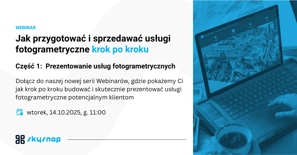
How to prepare and sell photogrammetric services step by step.
Choosing the right drone is a crucial step for any operator planning to carry out photogrammetric tasks. Even the best software or data processing (such as SkySnap) will not ensure quality if the source data - the images - are not taken with the right equipment.
In this article, we provide recommendations from SkySnap experts, backed by practical experience from projects in construction, agriculture and field inventory.
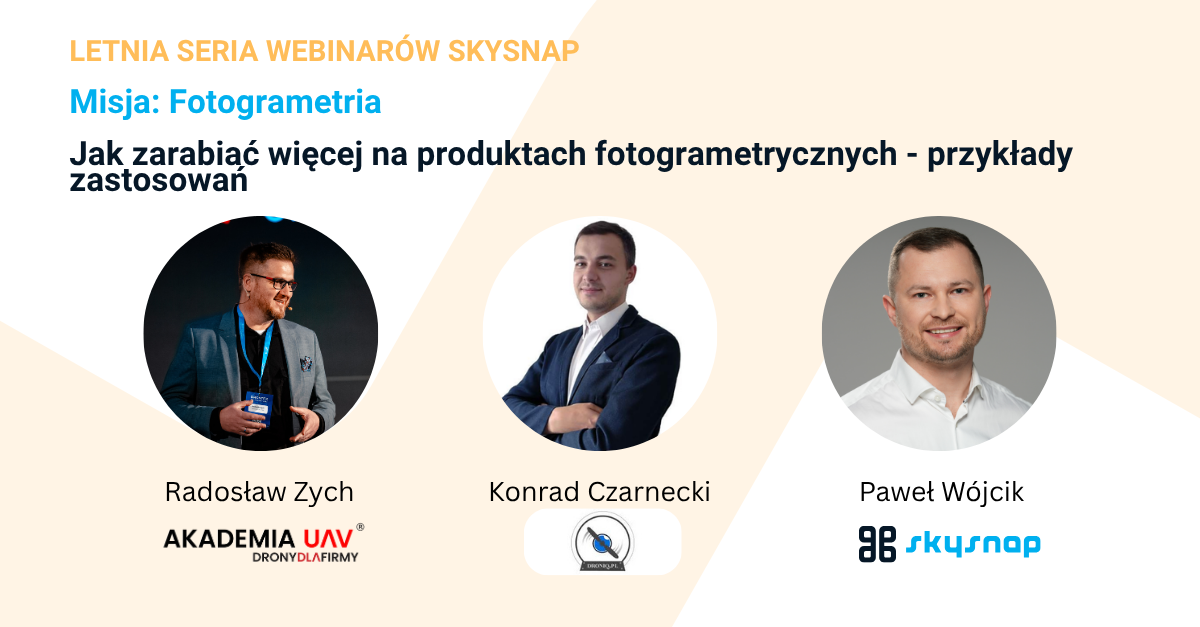
The increasing number of UAV operators means that competition in the photogrammetric industry is growing every month. Whether you offer orthophotos, roof inspections or heap volume calculations, how you communicate your offerings and reach the right customers is crucial. SkySnap's E-book "Service Examples and Marketing and Sales Tools" helps drone and surveying companies not only sell more effectively, but also understand the language of the customer and select the right promotional channels.
How to price photogrammetry services from a drone? Learn about factors affecting pricing, examples of billing models and download SkySnap's free e-book on pricing drone services. Keywords: drone services pricing, photogrammetry pricing, drone pricing, photogrammetry pricing, drone services calculator, SkySnap.
If you're just getting started with photogrammetry, you've probably come across abbreviations and terms that sound technical: RTK, PPK, GSD, LIDAR, DSM, DTM... In this article, we explain what they really mean - and which ones are worth knowing if you want to professionally monetize your drone data. Because a good knowledge of the basics will allow you to understand your customers' needs, choose the right equipment and create higher value-added services.

Learn how to make money from drones through photogrammetry. Check out the business potential in construction, surveying and agriculture. See what services you can offer today.
Learn a simple surveying dictionary: as-built map, base map, boundary erection, plot division, drone orthomosaic and many other terms. Practical definitions, application examples and help with formalities.
Learn how to properly plan a drone mission for a linear construction site and a 3D model of a roof. We compare principles, techniques and the most common mistakes.
Drone × Mission × Processing - the three pillars of accurate terrain mapping Orthophotomap is one of the most accurate terrain mapping available to construction, surveying and agricultural companies. It is created from photos taken from a drone, which are then processed in specialized photogrammetric software. But what exactly determines its quality?
Learn how to fit a drone raid into a geodetic layout: GCP, RTK, PPK, CRS and quality control. Step-by-step guide + checklists.
Drones in logistics enable accurate volume monitoring and better management of warehouse space.
The SkySnap portal supports general contractors and investors with 3D visualization and ongoing monitoring of investments.
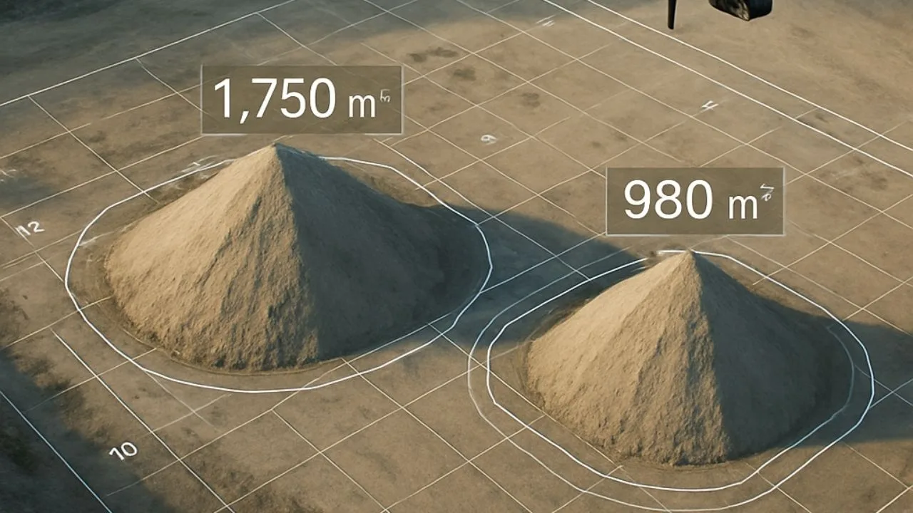
See how drones are revolutionizing heap measurements, offering greater accuracy and safety than traditional methods.

In the age of digitization of all kinds of information, [...]
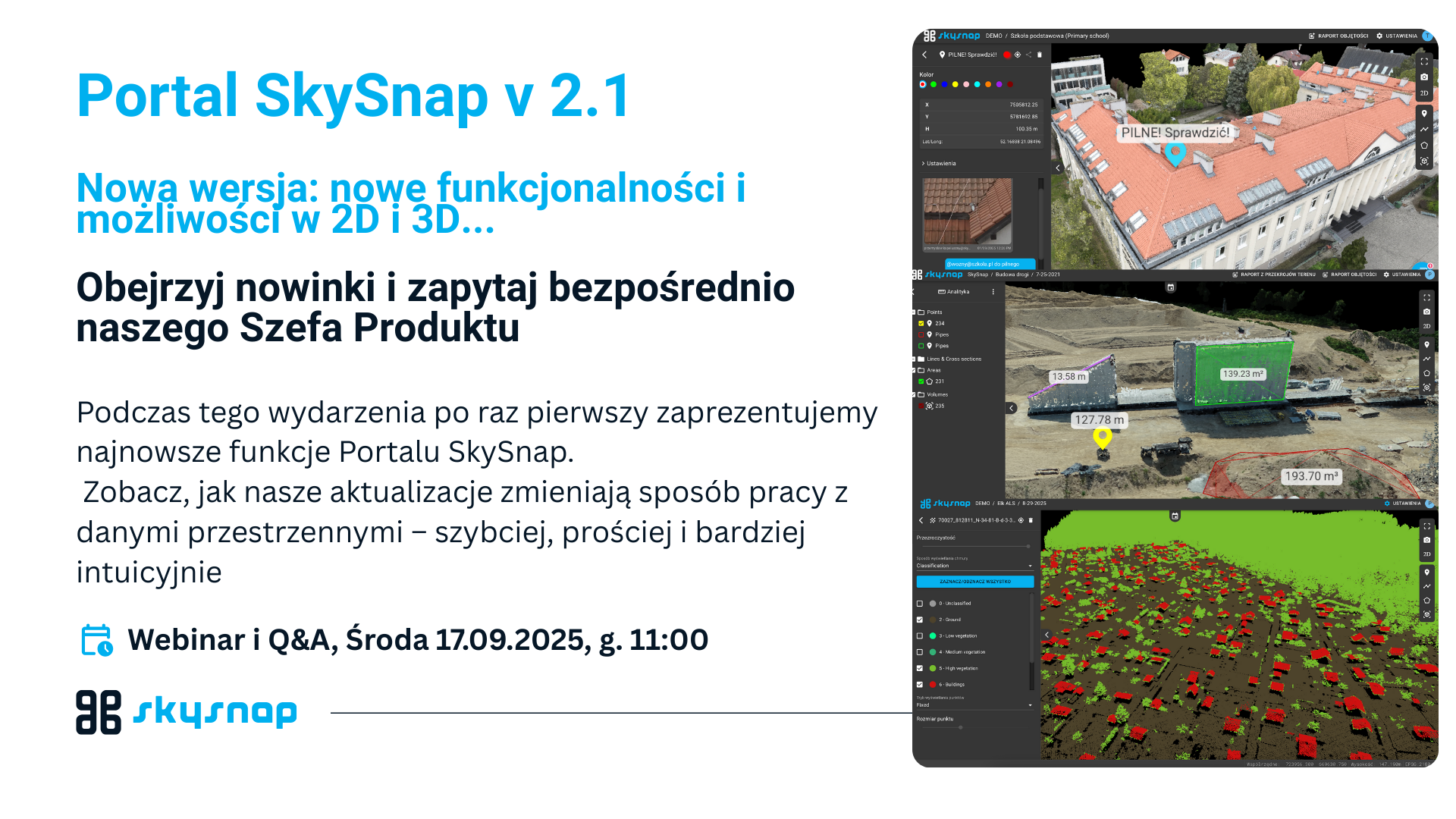
See how our updates are changing the way you work with spatial data - faster, simpler and more intuitive.
We are proud to announce that SkySnap will be present at the tenth anniversary edition of DroneTech World Meeting, which will be held on October 28-30, 2025 at Torun Plaza and Jordanki Cultural and Convention Center. This is a unique event that has been bringing together leaders and enthusiasts of unmanned technology from around the world for a decade - and this year is a double celebration for us, as SkySnap is also celebrating its 10th anniversary! 🎉
Automated reports and heap volume analysis enable accurate monitoring of materials in mining and logistics.
Check out how SkySnap Portal 2.0 allows you to detect changes and analyze progress in one place.
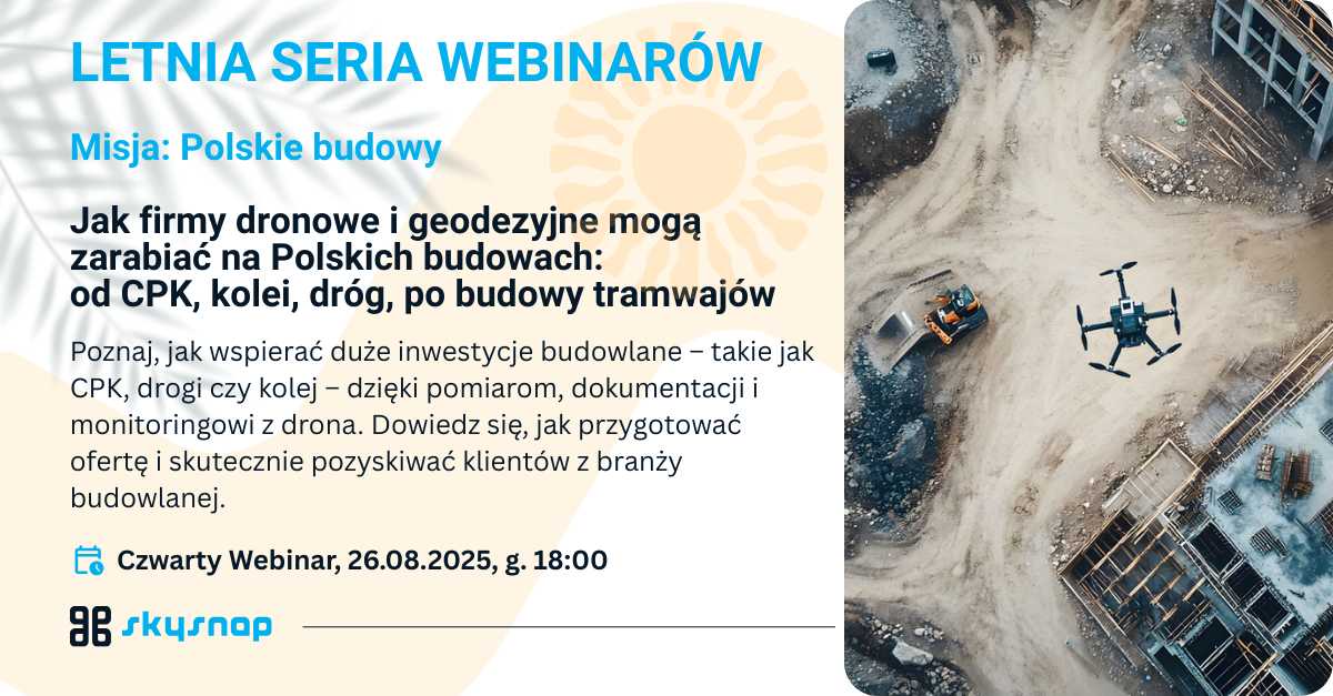
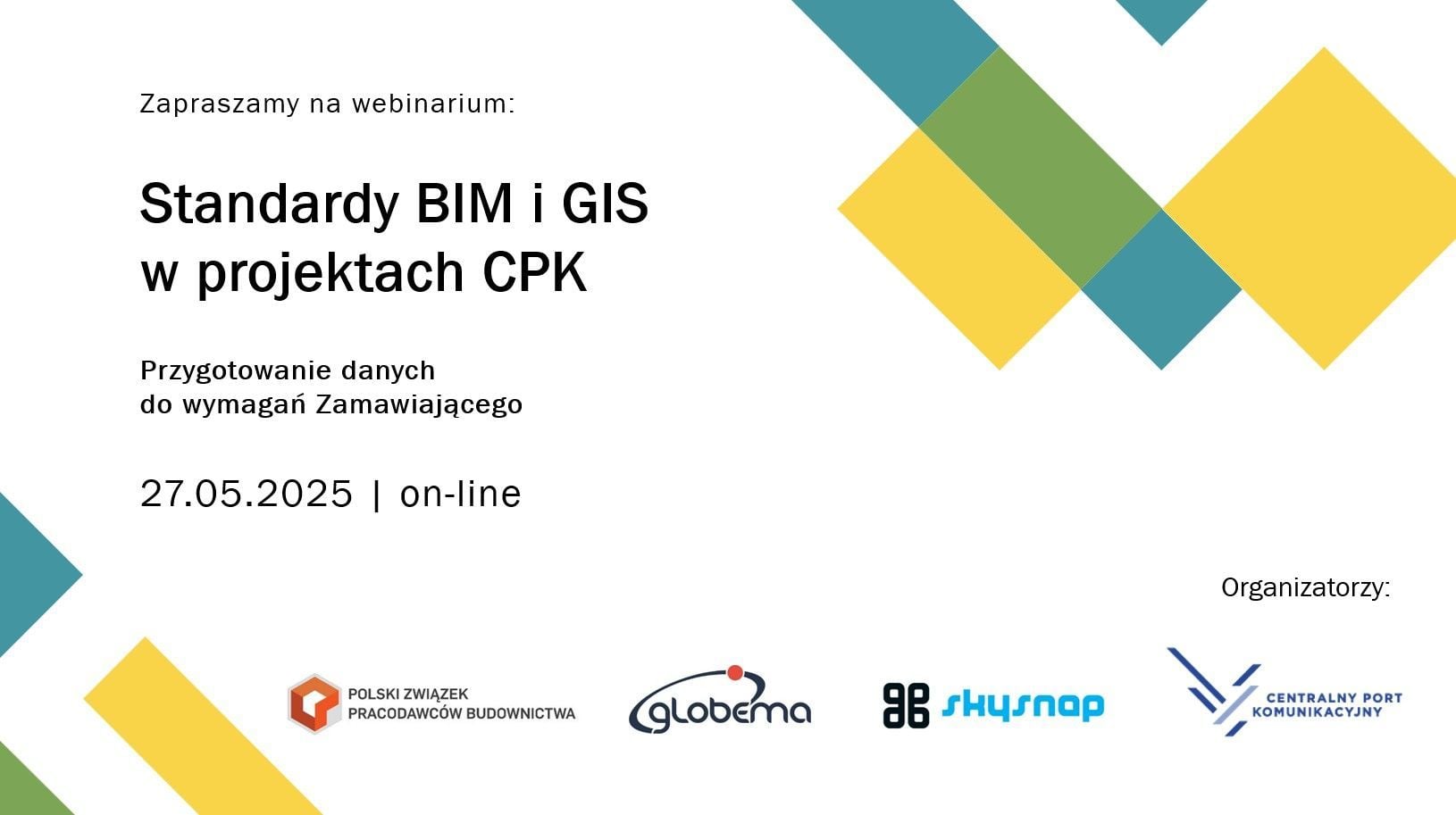
Learn how to support major construction projects - such as CPK, roads and railroads - with measurement, documentation and monitoring from a drone. Learn how to prepare a bid and effectively attract construction clients.
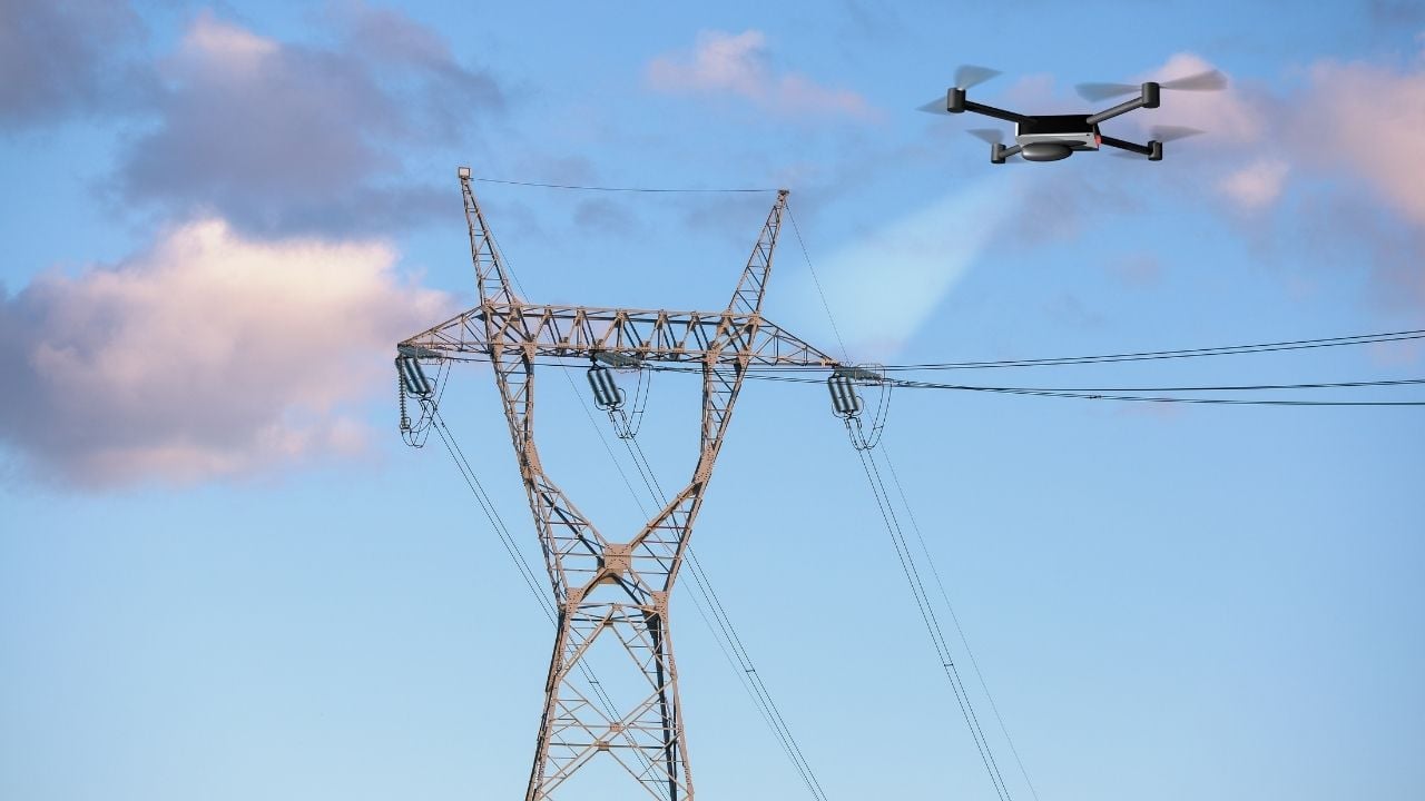
Inspection of power lines using drones allows for faster, safer and more accurate monitoring of infrastructure.
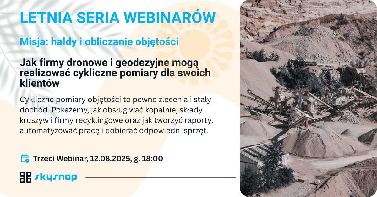
On August 12, 2025, a webinar was held on modern heap measurement and volume calculation methods using drones. Pawel Wojcik of SkySnap and Kamil Kaczorowski of Colidrone showed how UAV technology is changing the mining, construction and recycling industries, offering greater precision, faster turnaround times and higher job safety. They talked about the dynamic development of the drone market in the last decade - from the first DJI and Flytech models to advanced surveying systems - and how they have gained the trust of customers through efficiency and data quality.
Join our summer webinar series to learn how to really start monetizing your drone and geospatial data. Instead of flying aimlessly - learn about specific monetization paths and proven operating models.

Join our summer webinar series to learn how to really start monetizing your drone and geospatial data. Instead of flying aimlessly - learn about specific monetization paths and proven operating models.
Wondering how to save time and money when inspecting bulk material dumps? Traditional measurement methods often take days and are prone to error. See how, with the SkySnap Portal, construction companies can perform fast, accurate and frequent heap volume calculations at a fraction of the cost to date.

We are pleased to announce that SkySnap was among the technology companies invited to participate in the latest "Technology on the Construction Site" report compiled by Digital Real Estate. The publication is an independent overview of tools that realistically support construction processes - from planning to execution to operation.

Webinars
Recordings of our webinars and seminars
Check out our latest webinars. You can find them all on our SkySnap Webinars page
Property managers, communities and insurers are looking for operators who provide a complete report - not just flight footage. Most operators don't know how to structure and price it. In this webinar, we will walk you through the entire process from A to Z.
Free SkySnap webinar - 21.04.2026, at. 11:00. We will show a new inspection module for buildings and automatic data processing functions (3D models, orthophotos). Practical demo and implementation ideas for drone companies, surveyors and photogrammetrists.
The roof is one of the most expensive parts of a building... especially when problems are noticed too late. Leaks, damage or lingering water often remain invisible without an expensive and risky visual inspection.
What if you could check the condition of the roof quickly, accurately, and without climbing high?
During the webinar, we will show how to use roof inspection drones in practice - not just to take pictures, but to create real-world useful documentation that supports renovation decisions and conversations with contractors.
See our other webinars including archived recordings.
Partners section
We collaborate with partners on various levels
Useful materials for those interested in professional drone applications
In this section you will find the most important links and information regarding practical implementation of drones for professional use — from training and obtaining qualifications, through photogrammetry, to purchase, rental and the used drone equipment market, as well as industry events.
We have gathered practical tips and a list of recommended companies and events to help you choose the right training and match a drone to your business needs.
They write about us
Check publications about SkySnap in the press and other industry media
Useful information for anyone who wants to use drones, surveying systems…
Measuring land and buildings, environmental monitoring, or use in the [...]

Structures, natural landscapes and even individual objects are not always [...]
Contact
Fill out the form and arrange a presentation of our solutions.
Write or call us if you have any questions or need advice.


")
")

")
")