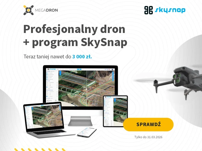
As part of the promotion, with the purchase of a DJI Matrice 4E or DJI Matrice 4D Combo, the customer will receive a SkySnap Portal for 6 months free of charge, valued at about PLN 3,000.
This is for those who want not only to acquire data from a drone, but also to efficiently process, analyze and share it with customers in a structured form.
Surveyor’s Day is a good time to make your job easier in real terms
The work of a surveyor today increasingly goes beyond just measuring in the field. What also matters is the speed at which materials are developed, the convenience of data analysis and the way in which the data is conveyed to the client. Therefore, the modern use of drones does not end with the execution of a raid. Equally important is what happens with the data afterwards.
It is this practical side of everyday work that the joint promotion of Megadron and SkySnap is responding to. It’s a simple action that combines professional equipment with a tool that organizes the entire work process with drone data.
What the promotion is about
The rules are simple:
- When purchasing a DJI Matrice 4E or DJI Matrice 4D Combo
- customer receives SkySnap Portal for 6 months free of charge
The promotion is valid until the end of March or while supplies last.
This is a ready-made package for professionals who want to get to the next level of working with field data and shorten the time from taking a flight to delivering the finished result to the client.
DJI Matrice 4E and DJI Matrice 4D Combo, equipment for professional applications
The models included in the promotion are solutions designed for professional applications, including tasks related to surveying, photogrammetry, investment documentation or analysis of changes in the field.
- The DJI Matrice 4E is for users who want an efficient tool for precise field work and high-quality data acquisition. This type of equipment is used wherever repeatable raids, efficient mission execution and the ability to use the data for further analysis are important.
- The DJI Matrice 4D Combo, on the other hand, is a solution for more demanding operational scenarios, where, in addition to data quality, operational flexibility and readiness for a professional service environment are also important.
For surveyors and BSP operators, choosing the right drone is the first step. The second is the efficient use of the acquired data. And this is where real added value comes in the form of the SkySnap Portal.
What the SkySnap Portal gives you in practice
The SkySnap portal is a tool that organizes the entire process of working with drone data, from processing to analysis to sharing the results with the client.
In practice, this means less manual work, less flipping of files between tools and less time spent technically pinning down the entire process.
Among other things, the user gains:
- Orthophotos and 3D models in one place
- Quickly share data with customers online
- measurements, reports and analysis without additional software
- access to projects from anywhere
- the ability to process data automatically or with expert support
It’s a solution that simplifies day-to-day work and allows you to focus on completing orders rather than organizing your work environment around files, exports and separate applications.
Less time at the computer, more time for more orders
From the point of view of a surveyor or a company providing surveying services, the greatest value of such a package is the practical time savings. The data collected in the field is to be turned into material as quickly as possible, ready for analysis, reporting or transfer to the client.
That’s why combining a professional drone with a tool like SkySnap Portal makes real business sense today. Instead of building an entire process out of many disjointed components, you get a cohesive solution that helps you operate faster and more predictably.
In practice, this means less time spent at the computer, and more time for fulfilling more orders and developing service offerings.
Offer for those who want to work modern
The promotion prepared by Megadron and SkySnap will be of interest to those who already use drones in surveying work, as well as those who want to enter the field more professionally.
This is a good opportunity to combine the purchase of hardware with access to a tool that immediately helps organize further work with data. For many companies, this can mean faster deployment, simpler project management and a more modern standard of customer service.
Promotion only until the end of March
The campaign is valid until the end of March or until stocks last, so those interested in buying should check the details of the offer well in advance.
Surveyor’s Day is a good time not only to celebrate the industry, but also to make it realistically easier to work in the field and back in the office. The DJI Matrice 4E or DJI Matrice 4D Combo package with 6 months of Portal SkySnap free of charge is an offer that addresses just this need.
Więcej o portalu SkySnap dla geodetów można przeczytąc tutaj https://skysnap.com/portal-skysnap-dla-geodetow/
Aby skorzystać z pakietu prosimy o wejście na www tutaj https://megadron.pl/pl/products/dron-dji-matrice-4e-dji-care-plus-1-rok-31055.html
lub kontakt telefonicznie +48 577888174

Free E-book
Learn how to prepare a mission step-by-step, avoid raid mistakes and create accurate orthophotos and 3D models. The perfect guide before your first commercial assignments.
Table of Contents:
Podoba Ci się artykuł? Podziel się nim z innymi!
Podoba Ci się artykuł? Podziel się nim z innymi!
Tips, news, insights
Related articles
Check out our articles and get the latest industry news.


")
")

")
")