How drones are changing construction: advanced surveying techniques
Drone technology has revolutionized many industries in recent years, and construction is no exception. Using advanced surveying techniques, drones enable precise data collection and analysis of construction sites, making construction work more efficient and precise. They allow architects and engineers to monitor project progress in real time, identify potential problems and optimize construction processes. In this article, we’ll take a look at how advanced drone measurement techniques for construction are changing the way we design and execute projects. Let’s learn how these flying devices are becoming an integral tool of modern construction.
Introduction to drones in construction
Drone technology has rapidly gained popularity in the construction industry, transforming the way construction projects are carried out. With their advanced surveying capabilities, drones are effectively assisting architects and engineers in their daily tasks.
History and development of drones
Drones, also known as unmanned aerial vehicles, were originally used mainly for military purposes. Over time, their use has expanded into various fields, including agriculture, photography and construction.
The origins of drone technology date back to the 20th century, when they were developed as surveillance tools. Technological evolution and miniaturization of components have allowed them to be widely used in civilian industry.
Today’s drones are equipped with modern sensors and cameras, making them invaluable tools for precise measurements and analysis.
Increasing popularity in the construction industry
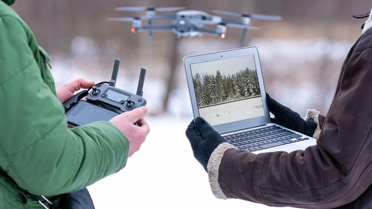
In recent years, drones have become extremely popular in the construction industry. The use of this technology allows for real-time monitoring of progress and identification of potential problems on the construction site.
With drones, it is possible to quickly obtain accurate terrain data, which helps in better planning and execution of projects. The increased popularity of drones in the industry is also due to their cost-effectiveness and versatility.
Working with drones allows for increased safety at construction sites, eliminating the need for direct human involvement in dangerous operations.
Advantages of drones in measurements
Drones bring numerous benefits to construction surveying, including speed, efficiency and precision, which are critical to the success of projects.
Speed and efficiency
When it comes to speed and efficiency, drones definitely stand out from traditional surveying methods.
- Time reduction: Drones can move quickly around a construction site, collecting data in less time than traditional survey teams.
- Enhanced performance: With the ability to operate in a variety of weather and terrain conditions, drones can take measurements regardless of the time of day.
- Resource optimization: The use of drones allows for better use of human resources, which can focus on other key tasks.
Thanks to these features, drones significantly speed up the planning and implementation stages of projects.
Precise measurement data
Precise survey data is the foundation of successful construction projects, and drones provide it with remarkable accuracy.
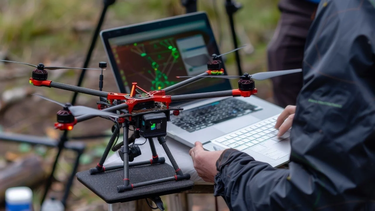
Drones are equipped with state-of-the-art sensors and cameras to collect high-resolution data. Precise measurements help avoid construction errors and save time and costs.
Analyzing drone data allows identifying and assessing risks at an early stage of a project, enabling a quick response to potential threats.
Advanced drone surveying techniques for the construction industry
The use of advanced surveying techniques, such as LIDAR and photogrammetry, is changing the way construction projects are designed and implemented.
LIDAR and photogrammetry
LIDAR (Light Detection and Ranging) and photogrammetry are two key technologies used by drones to collect data.
LIDAR allows precise terrain mapping by emitting laser beams that reflect off surfaces and return to the sensor. This makes it possible to obtain detailed maps and 3D models.
Photogrammetry, on the other hand, involves creating 3D images from photos taken from different perspectives. The two approaches are complementary, providing comprehensive data on terrain and structures.
3D mapping and terrain modeling
3D mapping and site modeling are processes that provide a better understanding of the topography and structure of a site before construction begins.
Drones can create detailed 3D maps that are invaluable for planning construction projects. Unlike traditional methods, 3D mapping using drones is faster and more efficient.
With terrain modeling, engineers can better predict and plan operations, avoiding potential terrain problems.
Practical applications in construction projects
Drones have found wide application in construction projects, supporting monitoring, inspection, and condition assessment.
Monitoring construction progress
Monitoring the progress of construction is crucial to managing construction projects, and drones significantly facilitate this process.
The drones allow regular flights over the construction site, providing up-to-date information on the progress of the work. This allows project managers to quickly identify delays or problems.
Drones also aid team communication by providing visual evidence of the current state of construction, which facilitates decision-making.
Inspections and condition assessments
Drones are indispensable in conducting inspections and condition assessments of buildings and infrastructure.
Equipped with high-quality cameras, the drones can identify damage and wear on materials that may not be visible to the naked eye. This allows early detection of problems and planning of necessary repairs.
Drone inspections are also safer for workers, eliminating the need to work at heights or in harsh conditions.
Challenges and the future of drone technology
Despite its many advantages, drone technology faces some challenges that need to be resolved to realize its full potential in construction.
Regulatory issues and safety
Regulatory and safety concerns are key issues that affect the use of drones in construction.
Regulations on drone use vary from country to country, which may hinder their use in some regions. In addition, the security of data collected by drones is an important issue that needs attention.
Complying with regulations and implementing appropriate safety measures is key to ensuring effective and safe drone use.
Innovations and future developments
Innovations in drone technology are opening up new opportunities in the construction industry, influencing the future direction of the industry.
- AI integration: Introducing artificial intelligence into drones can enhance their autonomy and ability to analyze data in real time.
- Augmented Reality: Combining drones with AR technology will enable even more advanced visualization and project planning.
- Improving range and performance: Work on improving the flight range and battery performance of drones is crucial to their future development.
These innovations will make drones an increasingly integral part of the construction industry.

Free E-book
Learn what services to offer, who to sell them to, and how to write an effective offer email. Ready-made templates, tips and examples of campaigns that really work.
Table of Contents:
Do you like the article? Share it with others!
Do you like the article? Share it with others!
Tips, news, insights
Related articles
Check out our articles and get the latest industry news.


")
")

")
")