SkySnap Portal for Surveyors
Take your surveying projects to a new level with drone technology, image analysis and online tools
Collect data faster and save time in the field, present measurement and analysis results in an interactive form on the online portal. Discover the potential of precise construction site mapping with drones and laser scanning.
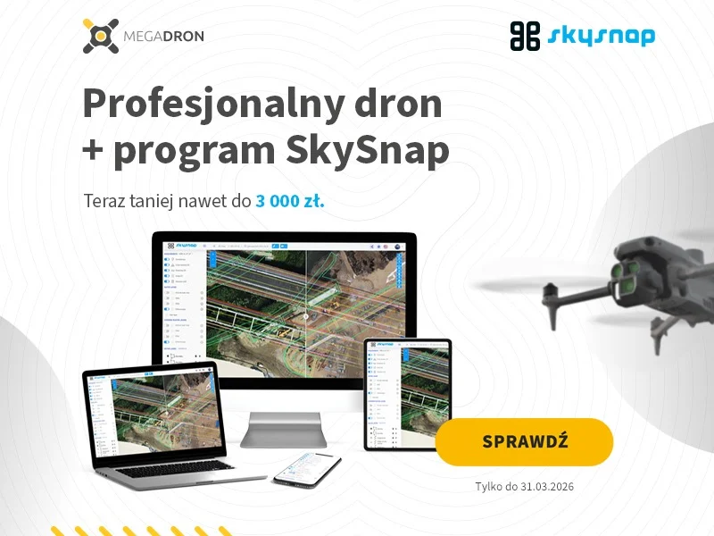
Special offer on the occasion of the day of the surveyor
On the occasion of Surveyor’s Day, Megadron and SkySnap have prepared a special promotional campaign for those who want to work faster, more convenient and more professionally. It’s an offer aimed at surveyors, drone operators and companies carrying out measurements, documentation and field analysis using BSP technology.
Click on the photo to learn more
Solutions for Surveyors
Our platform, designed with surveyors in mind, will help you:
Skysnap portal
Harness the power of drone and laser scanning data to make better decisions and optimize processes. The SkySnap portal will unleash the full potential of data on your surveying and construction projects.
We support decision-making
The Skysnap portal is an indispensable support for decision-making in complex infrastructure and construction projects at every stage of the project life cycle.
We support decision-making in complex construction projects at every stage of development.
Our technology enables:

Increase your effectiveness as a surveyor with precise site surveys and detailed reports at every stage of a project or development.
Increase your value in the surveying market with comprehensive and accurate land surveys and the creation of professional project visualizations. Use advanced techniques to analyze spatial data and integrate information from various sources.
Minimize the risk of surveying errors while offering high quality service, which will increase your attractiveness to customers. Use state-of-the-art surveying technology to anticipate and resolve potential field problems even before construction work begins. Provide precise data and maps that will become the basis for realistic schedules and effective investment planning.

Increase the accuracy and efficiency of your surveying services with state-of-the-art surveying technologies and spatial data analysis
Optimize your surveying services with advanced tools for precise field measurements and integration of data from different sources. Offer customers access to comprehensive surveying data from anywhere, enabling them to plan and make decisions efficiently.
Use your knowledge and skills to provide the critical information needed to accurately plan work, optimize schedules and effectively manage space and construction sites. Be an indispensable partner in the investment process by providing quality and best form surveying data.

Use your surveying skills to accurately monitor and analyze construction progress
Increase your value as a surveyor with comprehensive construction progress monitoring and analysis services. Compare actual site conditions with design assumptions using advanced surveying techniques and spatial data analysis.
Provide clients with precise reports on project milestones, quickly identifying any deviations from the plan. With your accurate measurements and analysis, investors and construction companies can optimize resource management and make accurate decisions in real time.
Present professionally compiled surveying data at construction councils and project meetings, enabling effective verification of completed work and planning of the next stages of the project. Be the key expert whose knowledge and skills are essential to the success of any construction project.

Increase your value in the project with precise surveying data that improves communication and collaboration among all project participants
Reinforce your position as a key expert in the investment process by providing accurate surveying data that is the foundation for effective project coordination and management. Ensure everyone has access to up-to-date and accurate site information throughout the project lifecycle, regardless of their location.
Effortlessly integrate and present data from a variety of sources, including ground and aerial surveys, enabling you to make informed design decisions. Your expertise in interpreting and analyzing spatial data becomes crucial in discussions about design changes or discrepancies with the plan. With your skills, communication based on accurate surveying data fosters better collaboration between project team members, supervision and subcontractors, creating a consistent and efficient work environment in which your role is irreplaceable.

Automate your surveying services with advanced reporting and ground progress monitoring tools
Increase the efficiency of your surveying services by using a tool to generate cross sections from drone and project data.
Monitor the progress of earthworks by offering earth mass volume data to customers. Calculate volume differences between the initial and current state with ease, and forecast design volumes from the current date.
The SkySnap portal will enable you to automatically generate PDF reports, saving you time. Offer comprehensive and repeatable analysis without having to go out in the field often, increasing your competitiveness in the surveying market.
Precise data and advanced analytical tools will allow you to settle projects faster and provide customers with detailed progress reports and sales operatives.

Give customers new ways to manage their construction sites with an on-call map
Stand out as an innovation leader in surveying, with the help of TaskList PRO’s electronic task log integration with the SkySnap geoportal.
- Share survey inventories ordered in TaskList PRO and completed in the form of an on-call map.
- Present customers with up-to-date data showing the precise location of measured objects in relation to the construction project.
- Identify potential collisions in advance and optimize the planning of subsequent construction work on site.
- Collect and visualize data at every stage of the project, enabling quick access to information for the people involved on site.
Give new tools to your customers so they can use surveying data in a different way than before and get to a higher level of understanding of the situation on their investment.

A solution that works
Selected customers
The SkySnap portal is already in use at some of Europe’s biggest players in the construction market, but our customers include a large number of Polish surveying companies:

Industry solutions
SkySnap has solutions for every industry
See what you can achieve through workplace management with SkySnap.


Start the digital transformation of your construction site with SkySnap
Increase investment profitability by controlling progress and taking measurements using online tools.
By performing timely workplace scanning and using automated tools to compare implementation status with the project, you can quickly check if you are on time and compliant with the project.

Contact
Fill out the form and arrange a presentation of our solutions.
Write or call us if you have any questions or need advice.


")
")

")
")