What is volume measurement with a drone?
The process consists of several steps:
1. air mission planning
First, we define the area to be measured. The drone is programmed to autonomously fly a grid pattern (so-called grid pattern), covering the entire area with appropriate image coverage (e.g. 70-80%).
2. collection of photogrammetric data
The drone takes hundreds of high-resolution images with proper coverage and GPS/RTK/PPK geolocation. Depending on the needs and precision, we use different drone models – from DJI Phantom 4 RTK to more advanced units with lidar.
3. data processing
The collected images are imported into specialized photogrammetric software (e.g., Pix4D, Agisoft Metashape, DJI Terra), where it is created:
- point cloud,
- orthophotomap,
- 3D model (TIN or mesh grid).
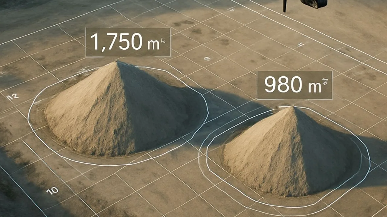
On this basis, it is possible to calculate the volume of each heap very accurately, taking into account the reference surface.
4. analysis and reporting
The end result is a volumetric report that includes:
net/gross volume of material (in m³),
- heap surface,
- Spatial data in various formats (e.g., .las, .dxf, .pdf),
- 3D visualizations of heaps.
Why use drones for volume measurement?
- Precision – measurement accuracy reaches up to ±1-3% compared to surveying methods.
- Speed – it takes about 15-30 minutes + processing time to measure the average heap.
- Safety – no need to climb heaps, risk to people = 0.
- Frequency – regular measurements possible, e.g., weekly or monthly
- Scalability – ideal for both a single heap and an entire storage yard.
Where are such measurements used?
- Aggregate plants and concrete plants
- Open pit mines
- Construction sites
- Road material depots
- Transshipment ports
How much does it cost?
The cost depends on the location, the number of heaps and the expected accuracy, but prices start as low as several hundred zlotys for a single measurement. With regular measurements it is possible subscriptions and cyclic reports, which improve the management of materials and logistics.
Summary
Aggregate volume measurement by drone is a technology that combines Engineering accuracy with modern automation. For companies that want to have real insight into their assets, save time and eliminate errors – it’s a solution that really pays off.

Table of Contents:
Do you like the article? Share it with others!
Do you like the article? Share it with others!
Tips, news, insights
Related articles
Check out our articles and get the latest industry news.


")
")

")
")