Webinars in series

Free SkySnap webinar - 21.04.2026, at. 11:00. We will show a new inspection module for buildings and automatic data processing functions (3D models, orthophotos). Practical demo and implementation ideas for drone companies, surveyors and photogrammetrists.

SkySnap webinar 6.11 (11:00-12:00, online): 2D/3D measurements, 360° panoramas, IFC/BIM, project management. Practice + Q&A. Join!
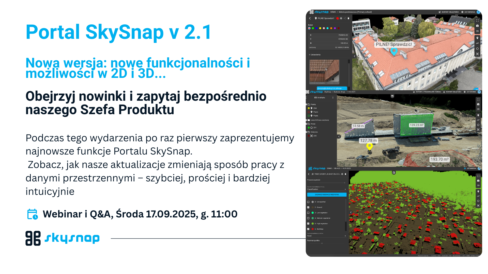
See how our updates are changing the way you work with spatial data - faster, simpler and more intuitive.
Related Articles

Warsaw, October 20, 2025. - SkySnap, a leader in spatial data analytics, announced the launch of a groundbreaking update to its portal on October 9, 2025, directly addressing the industry's growing needs for data interoperability and advanced 3D visualization. The new features, including full support for 360° panoramas, 3D DXF vector file import and advanced data export to DXF/CSV formats, are designed to fundamentally improve the work of surveyors, general contractors and designers.

Warsaw,September 15, 2025 - SkySnap, a leading provider of photogrammetric solutions, announces the release of a new version of its platform, SkySnap Portal. The update introduces a number of innovations that increase the precision of measurements, make it easier to work in 2D and 3D views, and expand the tool's accessibility with support for an additional language - German.

We are pleased to announce that SkySnap was among the technology companies invited to participate in the latest "Technology on the Construction Site" report compiled by Digital Real Estate. The publication is an independent overview of tools that realistically support construction processes - from planning to execution to operation.
SkySnap, a leading Polish provider of photogrammetric solutions, unveils a new version of its platform, SkySnap Portal Dedicated to surveyors, drone companies and general contractors in the construction industry.
Need more information?
Take a look at our Help Center – there you will find instructions, answers to the most common questions and guides to new features.

SkySnap
How can SkySnap help you with the topic of drone investment monitoring?
Accurate and Fast Inventory
Detailed data acquired from drones according to specifications for each identified object.
Reports
We perform analysis and measurements of infrastructure based on acquired data.
Dedicated Analysis and Measurement System
Online portal for easy data viewing, measurements, and collaboration among users.


")
")

")
")