How are geodetic maps from a drone changing the world of cartography?
Drony zrewolucjonizowały wiele dziedzin naszego życia, a kartografia nie jest wyjątkiem. Dzięki nowoczesnym technologiom, mapy geodezyjne z drona pozwalają na precyzyjne i szybkie tworzenie dokładnych obrazów terenu. Te innowacyjne narzędzia oferują nowe możliwości w zakresie pomiarów i analizy przestrzennej, co znacząco ułatwia pracę geodetów i urbanistów. W tym artykule przyjrzymy się, jak drony zmieniają podejście do mapowania oraz jakie korzyści niosą dla rozwoju kartografii. Zapraszamy do odkrycia, jak współczesna technologia kształtuje przyszłość mapowania.
Revolution in Cartography
Drony w ostatnich latach zrewolucjonizowały podejście do kartografii. Ułatwiają tworzenie szczegółowych map w krótszym czasie i z większą precyzją niż tradycyjne metody. W tej sekcji przyjrzymy się, jak zmieniały się mapy geodezyjne na przestrzeni lat i jaki wpływ na tę dziedzinę miały drony.
History of geodetic maps
Mapy geodezyjne istnieją od wieków, stanowiąc nieodłączny element urbanistyki i planowania przestrzennego.
Początkowo tworzone ręcznie, opierały się na pomiarach terenowych, które były czasochłonne i podatne na błędy. Dopiero pojawienie się technologii pomiarowych, takich jak teodolity i tachimetry, zrewolucjonizowało proces tworzenia map.
W 20. wieku nadeszła era satelit, co pozwoliło na bardziej precyzyjne mapowanie dużych obszarów. Jednakże, satelity mają swoje ograniczenia, zwłaszcza w trudnych warunkach atmosferycznych. Dzięki technologii GPS nastąpił kolejny przełom, umożliwiając bardziej precyzyjne lokalizowanie punktów na Ziemi.
Z kolei, drony wprowadziły nową erę w kartografii, łącząc zalety zarówno pomiarów terenowych, jak i satelitarnych. Dzięki nim proces mapowania stał się znacznie bardziej efektywny. Ich wszechstronność i dostępność sprawiają, że są idealnym narzędziem dla współczesnych geodetów.
The emergence of drone technology
Drone technology entered the civilian market relatively recently, but its development has been extremely rapid. Drones, also known as UAVs (Unmanned Aerial Vehicles), have gained popularity due to their ability to capture data quickly and accurately.
Initially, drones were used mainly for military purposes, but their use quickly expanded into many different fields. Over time, they gained popularity in surveying and mapping, offering new possibilities for terrain imaging.
Drones are currently being used to create detailed 3D maps and analyze changes in the terrain in real time. Their ability to traverse difficult terrain and take measurements in hard-to-reach areas makes them an indispensable tool for many applications.
Application of Drones in Surveying
The introduction of drones into surveying has opened up new opportunities for mapping and spatial analysis. In this section, we will discuss what advantages drones have over traditional methods and provide examples of their practical applications.
Advantage over traditional methods
Drones offer many advantages over classic surveying methods. First of all, they allow fast and precise data collection over large areas. Traditional methods are often labor-intensive and time-consuming.
- Efficiency: Drones can cover large areas in a short period of time, significantly reducing operating costs.
- Accessibility: They can reach hard-to-reach areas that would be challenging for traditional methods.
- Precision: Modern drones are equipped with advanced sensors to create accurate 3D models.
With these advantages, drones are becoming increasingly popular in the surveying industry and are ideal for projects that require fast and accurate mapping.
Examples of practical applications
Drony znalazły zastosowanie w wielu dziedzinach geodezji. Przyjrzymy się kilku praktycznym przykładom, które ilustrują ich wszechstronność.
- Monitorowanie infrastruktury: Drony są używane do inspekcji mostów, dróg i innych obiektów infrastrukturalnych, dostarczając szczegółowych danych dotyczących ich stanu.
- Kartografia rolnicza: Pomagają w analizie upraw, umożliwiając rolnikom optymalizację plonów i monitorowanie zdrowia roślin.
- Zarządzanie kryzysowe: W sytuacjach awaryjnych drony mogą szybko dostarczać aktualne mapy, co jest nieocenione w planowaniu działań ratowniczych.
Każdy z tych przykładów pokazuje, jak drony mogą być wykorzystywane do zwiększania efektywności i dokładności w różnych procesach kartograficznych.
Technology and Innovation
Drones are not just flying devices; they are advanced platforms that combine modern technologies. In this section, we will discuss how drones work in mapping and what modern software supports their operation.
How drones work in cartography
Drony kartograficzne są wyposażone w różnorodne sensory i kamery, które zbierają dane z lotu. Proces mapowania z użyciem drona można podzielić na kilka kluczowych etapów.
- Planowanie misji: Ustalany jest plan lotu, uwzględniający obszar do zmapowania oraz wymagane parametry lotu.
- Zbieranie danych: Dron wykonuje lot, rejestrując obrazy i dane za pomocą wbudowanych czujników.
- Analiza danych: Zebrane dane są przetwarzane w specjalistycznym oprogramowaniu, które generuje mapy i modele 3D.
Dzięki tej technologii proces mapowania jest znacznie szybszy i bardziej precyzyjny niż tradycyjne metody.
Modern mapping software
Software is a key element in using drones for mapping. Modern software offers advanced features that facilitate data processing and analysis.
- Automation: The programs allow automatic data processing, which speeds up the whole process.
- 3D analysis: the software allows the creation and analysis of 3D terrain models, which is extremely useful in surveying.
- GIS integration: Drone data can be easily integrated with geographic information systems (GIS), enabling advanced spatial analysis.
Ultimately, the development of mapping software is crucial to the effective use of drones in mapping.
Challenges and the Future
Although drones are revolutionizing cartography, their use comes with some technological and legal challenges. In this section, we will discuss these barriers and the prospects for development in mapping.
Technological and legal barriers
The use of drones faces various obstacles that can limit their effectiveness. Technological limitations include battery life and operating range. Drones require frequent recharging, which can be problematic when mapping large areas.
In addition, laws regarding drone flights vary from country to country and can affect their applicability. In many places, special licenses and flight approvals are required, which can be a barrier for some users.
Despite these challenges, advances in technology and regulatory changes may contribute to more widespread and effective drone use in the future.
Development prospects in cartography
Przyszłość kartografii z pewnością będzie ściśle związana z technologią dronów. Ich rozwój może przyczynić się do jeszcze większej precyzji i efektywności mapowania.
- Miniaturyzacja: Postęp technologiczny prowadzi do tworzenia mniejszych, bardziej wydajnych dronów.
- Sztuczna inteligencja: Integracja AI w procesach mapowania może zwiększyć automatyzację i precyzję analizy danych.
- Zwiększona autonomia: Prace nad autonomicznymi dronami mogą umożliwić dłuższe i bardziej skomplikowane misje bez potrzeby ciągłej interwencji człowieka.
Te innowacje mogą zrewolucjonizować sposób, w jaki tworzymy i analizujemy mapy w przyszłości.
Impact on Various Industries
The use of drones in mapping has wide-ranging implications for various industries. In this section, we take a look at how drones are affecting agriculture, land management, urban planning and city planning.
Agriculture and land management
Drones in agriculture offer many benefits for crop monitoring and land management. They make it possible to accurately analyze plant health and identify problems at an early stage.
- Precision farming: With drones, farmers can optimize the use of fertilizers and pesticides, leading to higher yields.
- Land inventory: Drones make it possible to map agricultural areas quickly and accurately, which is especially useful for crop planning.
Their use in agriculture contributes to more sustainable and efficient resource management.
Urban and regional planning
In urban planning, drones are used to map urban areas quickly and accurately. They enable better urban planning, which is crucial in today’s dynamic urban environment.
- Infrastructure planning: Drones provide detailed data to help design roads, bridges and other infrastructure.
- Crisis Management: In emergency situations, drones provide up-to-date maps, which is invaluable for planning rescue operations.
This allows cities to be more prepared for the future challenges of development and space management.
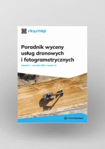
Free E-book
Learn proven methods for pricing jobs: From building structures to large linear and space raids. This guide will help you earn effectively and confidently.
Table of Contents:
Do you like the article? Share it with others!
Do you like the article? Share it with others!
Tips, news, insights
Related articles
Check out our articles and get the latest industry news.


")
")

")
")