The last decade has brought many breakthrough technologies that have completely changed the way we work, live and communicate. One of them is drones, which have become an indispensable tool in many industries, from photography and film to agriculture and industry. In this article, we will focus on an aspect that has an undeniable impact on earth geometry, namely – how drones are changing heap measurements .
Traditional methods of measuring heaps
Traditional methods of measuring heaps were time-consuming, labor-intensive and potentially dangerous. Using tachymeters, GPS or total survey stations not only required a lot of time and skill, but also exposed workers to potential accident risks. What’s more, these measurement methods were not always accurate, especially when large areas were involved.
How drones are changing heap measurements
This is where drones come in. These small and lightweight flying machines are capable of taking accurate measurements of large areas in a short period of time and without exposing workers to any risk. Using advanced technologies such as photogrammetry and LiDAR, drones can create precise 3D maps of an area and then use that data to precisely measure heaps.
The advantage of technology
The advantage of drones over traditional heap measurement methods is evident on many levels. First of all, with drones we can estimate the volume of heaps with unprecedented precision. Drones are also extremely versatile – they can fly at different heights, around heaps, above them, and even inside them, allowing us to better understand heap structure and characteristics.
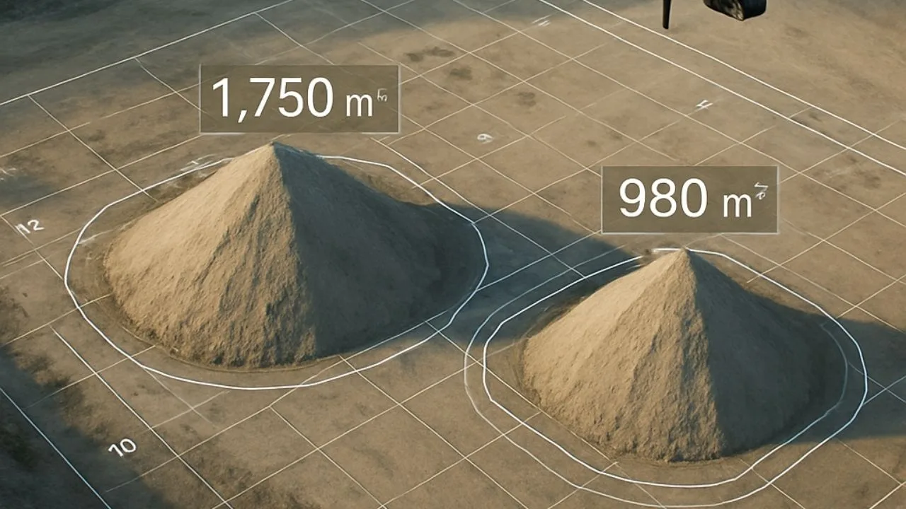
How does it work?
The process of measuring heaps with drones is simple and efficient. A drone equipped with a suitable camera and 3D mapping software flies over the area, creating hundreds or even thousands of photos. These photos are then combined using special software, creating an accurate 3D map of the area. This map can then be used to make precise measurements of heap volumes.
Coming to the end of our topic about drones changing heap measurements, we want to emphasize that the advantage of technology in this area is undeniable. Thanks to drones, heap measurements are becoming faster, safer and more precise, which translates into savings in time and money, as well as greater safety for workers. An industry that decides to fully exploit the potential of this technology will certainly gain a huge advantage.

Free E-book
Learn how to prepare a mission step-by-step, avoid raid mistakes and create accurate orthophotos and 3D models. The perfect guide before your first commercial assignments.
Table of Contents
Tips, news, insights
Related articles
Check out our articles and get the latest industry news.


")
")

")
")