What is BIM and what is its significance for the construction industry?
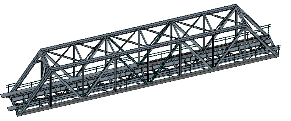
BIM (Building Information Modeling), or building information modeling, is a modern method of managing information in the investment process. Unlike traditional 2D documentation, BIM is based on an intelligent 3D model, which includes not only the geometry of the building, but also technical, material, cost and schedule data.
In practice, this means that BIM acts as a common source of information for all participants in the construction process, such as designers, contractors, investors and facility managers. Every change made to the model is automatically updated, which significantly reduces the risk of errors, design collisions and misunderstandings resulting from working on outdated documentation.
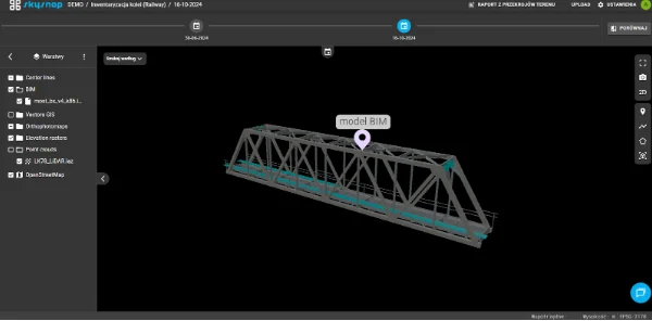
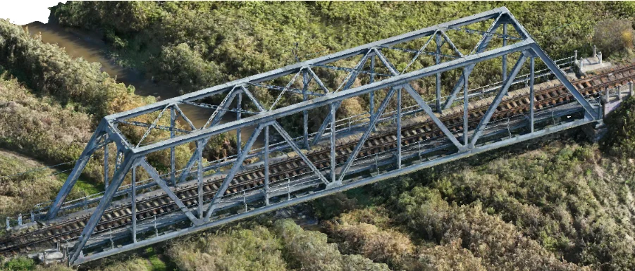
BIM technology is gaining particular importance in the context of the digitization of construction. More and more companies are using it not only at the design stage, but also directly on site, integrating the model with field data and measurements from drones. An example is the SkySnap Portal, which allows BIM models to be viewed in IFC* format, combined with up-to-date orthophotos, point clouds, photo documentation and surveying measurements – in a single digital environment accessible online from a web browser.
*IFC (Industry Foundation Classes) – the most important and widely used file format of the openBIM ecosystem; a key component of this environment.
The use of BIM on construction sites – what does it look like in practice?
BIM at the design stage
At the design stage, BIM makes it possible to coordinate architecture, construction and installation simultaneously within a single coherent model. This approach allows early detection of clashes between the various trades, which in the traditional design process often only become apparent during the execution of construction work.
From a construction practice perspective, this means fewer design errors and better quality documentation, among other things. Importantly, modern platforms – such as SkySnap – also make it possible for people who do not work in advanced engineering tools on a daily basis to access BIM models. With IFC’s browser-based functionality, designers and builders can jointly analyze models, comment on elements and better manage documentation. All this without having to install specialized software.
BIM in the course of development
On the construction site today, the BIM model serves as a digital reference point – not only for the design office, but also for construction managers, engineers and contractors. Increasingly, solutions are being used to juxtapose the model with the actual state of the works, using data from drone photogrammetry or scanning.
SkySnap enables just such juxtapositions. Users can overlay BIM models on top of actual point clouds, comparing the designed object with the actual state, for example, based on drone images taken periodically during construction. What’s more, advanced AI algorithms analyze this data and automatically detect key elements, (such as structural elements, heaps or earthwork scopes), making it easier to inspect and faster to verify that workmanship matches the model.
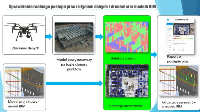
With such tools, BIM becomes a real support in the ongoing execution of work, not just a reference document “in theory.” It is also a step towards building a fully digital construction site, supported by automation and artificial intelligence.
BIM model after construction
With the completion of the work, the BIM model does not lose its importance – on the contrary, it becomes the starting point for effective facility management. The data contained in the model makes it possible to plan maintenance, optimize maintenance costs or perform operational analyses.
If the model was supplemented with field data during construction – as is the case in projects using SkySnap – it is also possible to accurately represent the actual construction of the facility, which significantly increases the value of as-built documentation. Automated AI detection can be used here, for example, to identify items that need inspection or for ongoing monitoring of infrastructure.
BIM integration with drone data
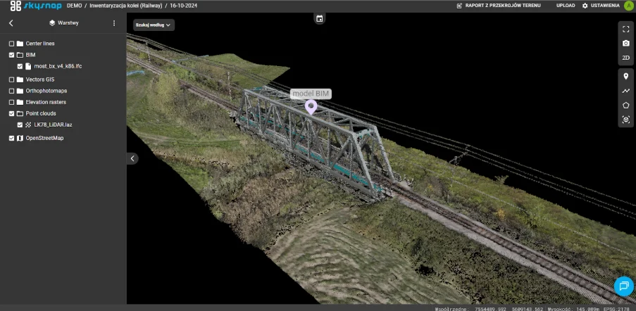
In SkySnap, IFC file handling is done directly in the browser. Simply load the model and you can view it, analyze object properties, comment on individual elements, or compile it with field data. It’s a solution available to BIM specialists as well as technical people on the contractor or developer side.
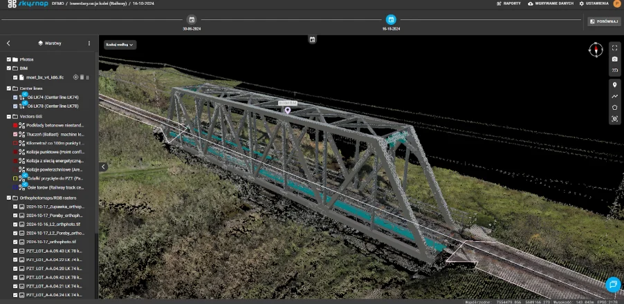
What sets SkySnap apart from other tools is its ability to integrate BIM models with real data from the construction site: orthophotos, surveying measurements and drone photo documentation. This makes it possible to monitor investments from the air, precisely control the progress of works and quickly detect discrepancies between design and execution.
In addition, the AI-based system makes it possible to automatically classify detected objects and analyze changes over time – for example, detecting differences in object geometry between consecutive weeks of construction. This is a huge convenience for teams responsible for supervision, as-built documentation and reporting to the investor.
Summary
BIM technology supports construction processes at every stage: from design to construction to facility management. It enables better interdiscipline coordination, reduces errors, and allows for ongoing control of schedules and costs.
The SkySnap platform extends the capabilities of working with BIM by integrating IFC models with actual data from the construction site (drone images, orthophotos, surveying). This allows users to compare the project with reality and react faster to discrepancies.
Additional support is provided by the use of artificial intelligence algorithms that automatically detect objects and changes on site, supporting the analysis of construction progress and updating the BIM model. As a result, SkySnap facilitates the daily work of technical teams and allows them to use the potential of digital tools on site more effectively.
See for yourself how geospatial data can improve your investment.
You can do it completely free of charge. You are invited to test the SkySnap Portal. Create an account and upload your own data: orthophotos, point clouds and BIM models in IFC format to see what a digital construction site looks like in practice.
You may also be interested in:

The roof is one of the most expensive parts of a building... especially when problems are noticed too late. Leaks, damage or lingering water often remain invisible without an expensive and risky visual inspection.
What if you could check the condition of the roof quickly, accurately, and without climbing high?
During the webinar, we will show how to use roof inspection drones in practice - not just to take pictures, but to create real-world useful documentation that supports renovation decisions and conversations with contractors.

Property managers, communities and insurers are looking for operators who provide a complete report - not just flight footage. Most operators don't know how to structure and price it. In this webinar, we will walk you through the entire process from A to Z.

Free SkySnap webinar - 21.04.2026, at. 11:00. We will show a new inspection module for buildings and automatic data processing functions (3D models, orthophotos). Practical demo and implementation ideas for drone companies, surveyors and photogrammetrists.
Managing a modern building is a constant battle against the passage of time and the destructive influence of nature. Whether you're looking after an office building, an industrial hall or a housing development, the greatest dangers lurk where the eye can't see - in the highest parts of the structure and in hard-to-reach places. The roof, gutters, flashings and facade details are the front line in the clash with rain, frost and UV radiation.

It used to be that inventories of waterfronts and reservoirs required difficult point measurements. Today, unmanned technology and the use of bathymetry make it possible to create a complete set of depth data. Having data from above and below the water yields a continuous terrain model which allows for earthwork measurements and spatial analysis.

Measuring land and buildings, environmental monitoring, or use in the [...]

On the occasion of Surveyor's Day, Megadron and SkySnap have prepared a special promotional campaign for those who want to work faster, more convenient and more professionally. It's an offer aimed at surveyors, drone operators and companies carrying out measurements, documentation and field analysis using BSP technology.
Structures, natural landscapes and even individual objects are not always [...]

Learn how drones support property managers and housing communities in inspections and documentation. Webinar 24.03 at 11:00 a.m. Check out practical implementations.

Free E-book
Find out how UAV and AI support investment supervision, facilities management and the daily work of engineers. Learn about real-world applications of technology in construction and real estate.
Table of Contents:
Do you like the article? Share it with others!
Do you like the article? Share it with others!
Tips, news, insights
Related articles
Check out our articles and get the latest industry news.