Drone photogrammetry
Using a drone for aerial photography can yield impressive-looking images, but aerial photogrammetry can yield impressive value for clients and allow drone pilots to monetize their skills in multiple ways.
Surveying and mapping
Surveying and mapping is the name of the business. This is where you add a lot of value for potential clients by converting simple images into 2D maps or 3D models which can then in turn be used for measurements or analysis.

Fig 1. The process
From data acquisition to final product.
Here, as any professional knows, precision and accuracy are key to success on any project. Having your measurements off by 1 foot can mean the difference between quality results and results which can get you fired.
We have flown more than 5000 photogrammetric missions. We have worked on projects which required very high precision and accuracy and those which allowed us to experiment with the settings.
One key lesson we learned – if you want to be in the drone business it’s best you reach your targets with the least amount of effort. So what is the sweet spot? We want to tell you about our findings in this and in the following articles.
TABLE OF CONTENTS:
4 factors accuracy of drone photogrammetry
Let’s start with the overview. In short, there are 4 telling factors about accuracy of datasets from photogrammetric flights:
In this article we will focus on the first factor – Ground Control Points (GCP).

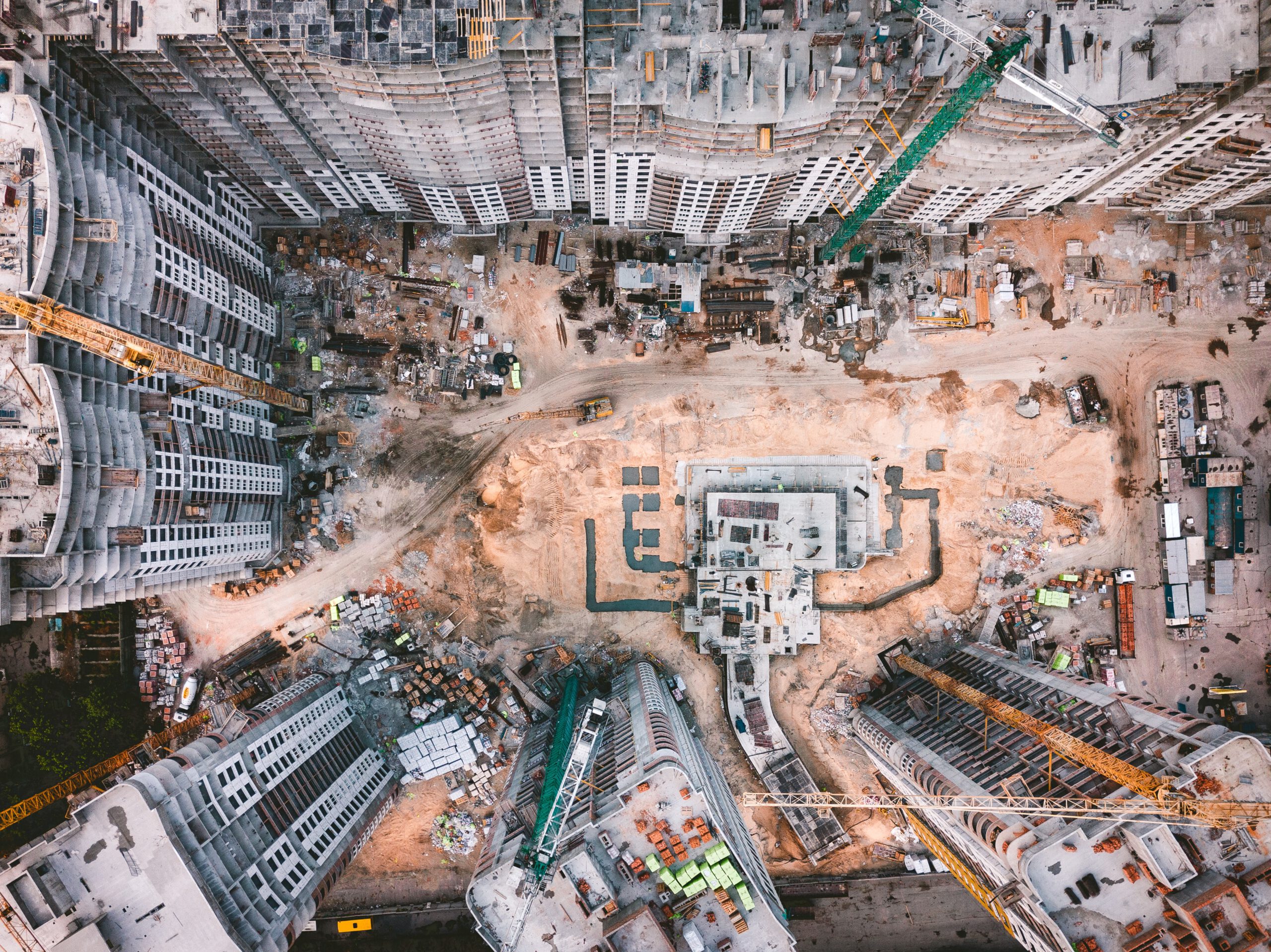
Fig 2.1. Road Construction
Good material and process results in engineering grade quality which can be used for construction control

Fig 2.2. Road Construction close up
Good material and process results in engineering grade quality which can be used for construction measurements
GCP
Ground Control Points
So what is a GCP? It is any point on the ground, precisely measured with survey-grade accuracy, and whose mark can be clearly identified in drone images.
To use efficient GCP’s on your project you have to:
1. Distribution of GCP’s across the project area
Distribution of GCP’s:

Fig 3. GCPs distribution
Distribution of GCPs across project area (drone with RTK)
2. Highest possible accuracy of GCP’s
To achieve the highest possible accuracy on your project you should use GCP’s with a checkerboard pattern. This shape leaves very little ambiguity about where to measure your point – always measure at the center of the cross.
You should use GCP’s that have contrasting color patterns. This is why most GCP’s are black and white. It is easier to recognize high contrasting patterns when marking GCP’s on drone images.

Fig 4. Ground Control Point
Source: https://www.pix4d.com/blog/why-ground-control-points-important
3. Measure the GCP’s
Now it’s time to measure the GCPs. In most cases, GCP’s are measured by a GNSS RTK receiver with survey-grade accuracy. If you use a high quality receiver you will save time in the field and this will yield better results.
4. Take flight – use your drone
Fly and obtain high quality images! We fly with RTK/PPK drones like the Wingtra One, but there are many different drones on the market that will produce fantastic results.
5. GCP’s software
Process using GCP’s – leave at least twenty percent of your GCPs out of your calibration, so you can use them as checkpoints.
6. Check the accuracy
Next, we check the accuracy of our processed data by using our checkpoints. Hey, here is a bonus question…. What is the difference between CHECKPOINT and a GCP? They get confused sometimes but the difference is simple. A CHECKPOINT is a designated GCP. CHECKPOINTS look the same and get measured in the same way as a GCP. A GCP actually becomes a CHECKPOINT when you decide it will not take part in the calibration step and will only be used to check the accuracy of your final photogrammetry outputs. In short, any GCP on a project can be used as a CHECKPOINT. . Just make sure you: A) Try not to use the GCP’s you distributed on the corners of your AOI and B) make sure you have the right balance between GCP’s and CHECKPOINTS. We recommend that you have at least 1 checkpoint for every 5 GCP’s.
To check the accuracy of your project, simply compare the location of a CHECKPOINT obtained from direct measurement in the field (GNSS RTK Receiver) and the location of the same CHECKPOINT on a calibrated image or orthomosaic. The difference between these two is your estimated accuracy.
GCP’s are used to precisely georeference a dataset, CHECKPOINTS define the accuracy of this georeference.
SkySnap.com – The right platform for your data
If you are in the drone business, doing a lot of photogrammetry and measurement work like us, you probably have spent some time thinking about the right software to store, share and measure your data. We looked at the available platforms. We knew very well from our experience what kind of challenges drone pilots and businesses who work with both 2D and 3D data face on a daily basis.
Online software
We decided to use our experience to create SKYSNAP.COM. Our online software helps drone pilots, construction project teams, engineers/surveyors, asset-managers and anyone who works with 2D/3D data make informed and timely decisions.
Solutions
Our platform allows you to:
Let’s talk
If you are thinking about scaling your services or have challenges with sharing your data effectively with the client, give us a shout at www.skysnap.com. We can set you up with a quick demo so you can FREE your data.
We hope this material was helpful.
We will share the findings on the next key component of quality material namely – quality images in the next piece.
If you have any questions concerning photogrammetry or you want our help processing your drone data, don’t hesitate to give us a shout.
Like the article? Spread the word
Like the article? Spread the word
Tips, news, insights
Related articles
Check our articles and get newest industry insights.